1/22/22: I love the Tetons in winter but haven’t been in the past few years. We got to spend this weekend there, and it did not disappoint.
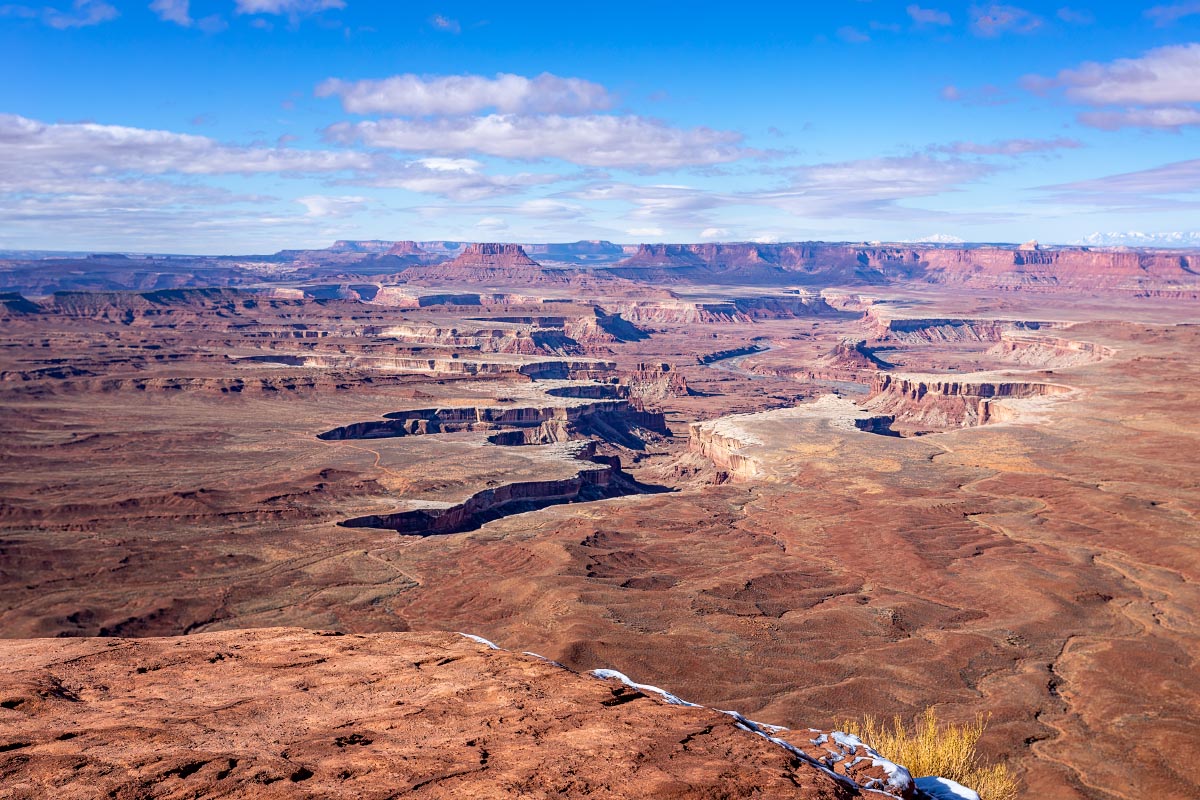
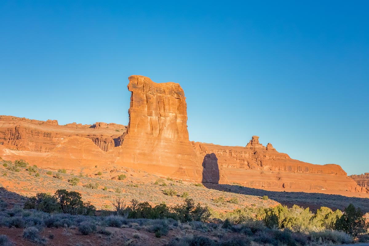
Snake River Canyon
Snake River Canyon
Snake River Canyon
Snake River Canyon
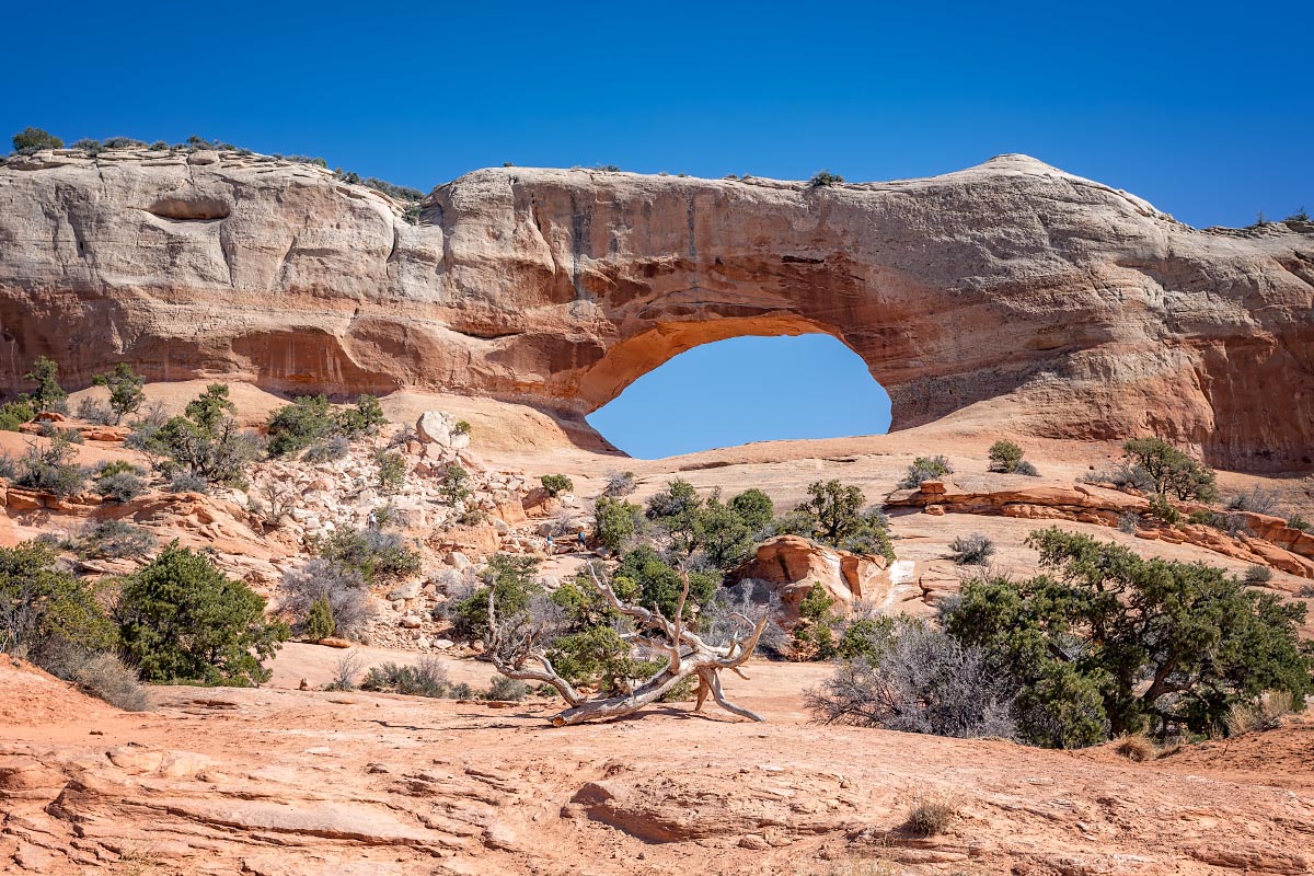
The Wedding Trees
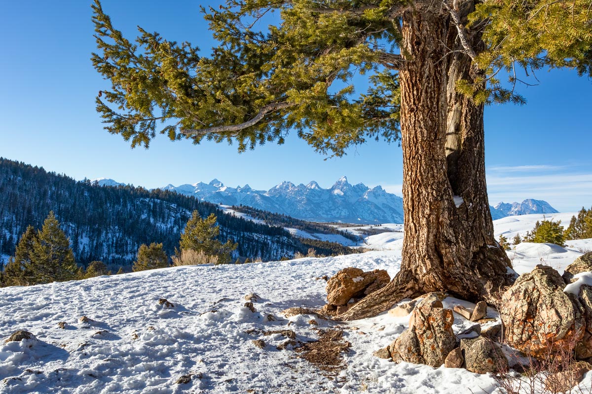
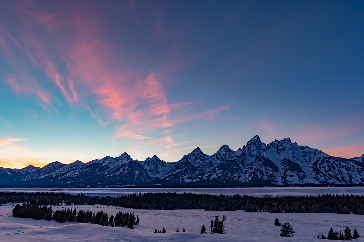
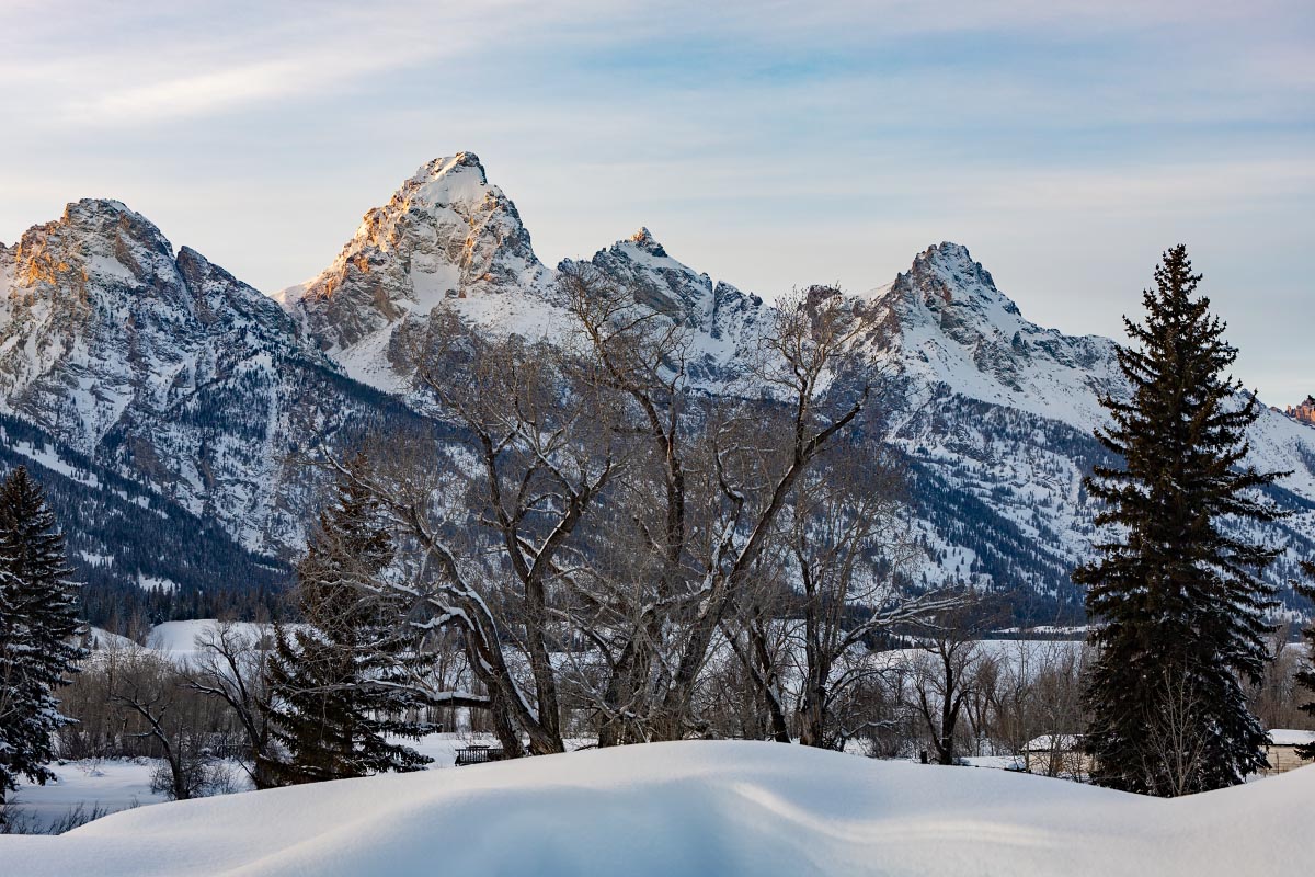
Teton sunset
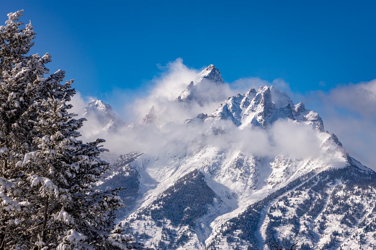
Snake River Overlook
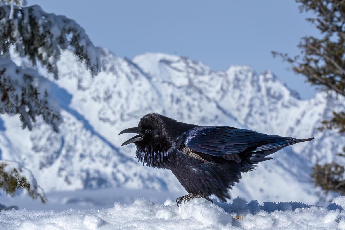
Common Raven
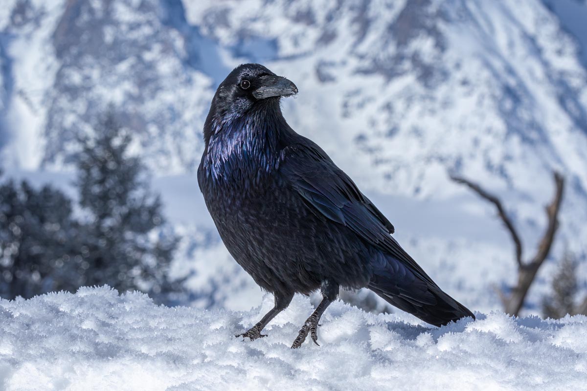
Common Raven
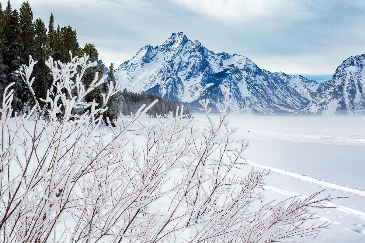
Hoarfrost along Jackson Lake
Teton sunset
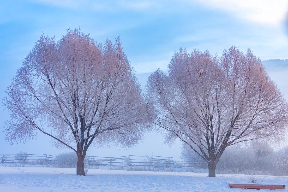
Not sure what type of trees these are, but the slight red color of the branches tinted the hoarfrost pink.
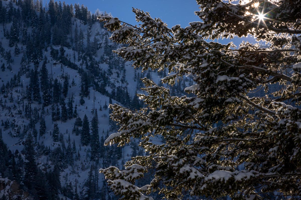
Hoarfrost
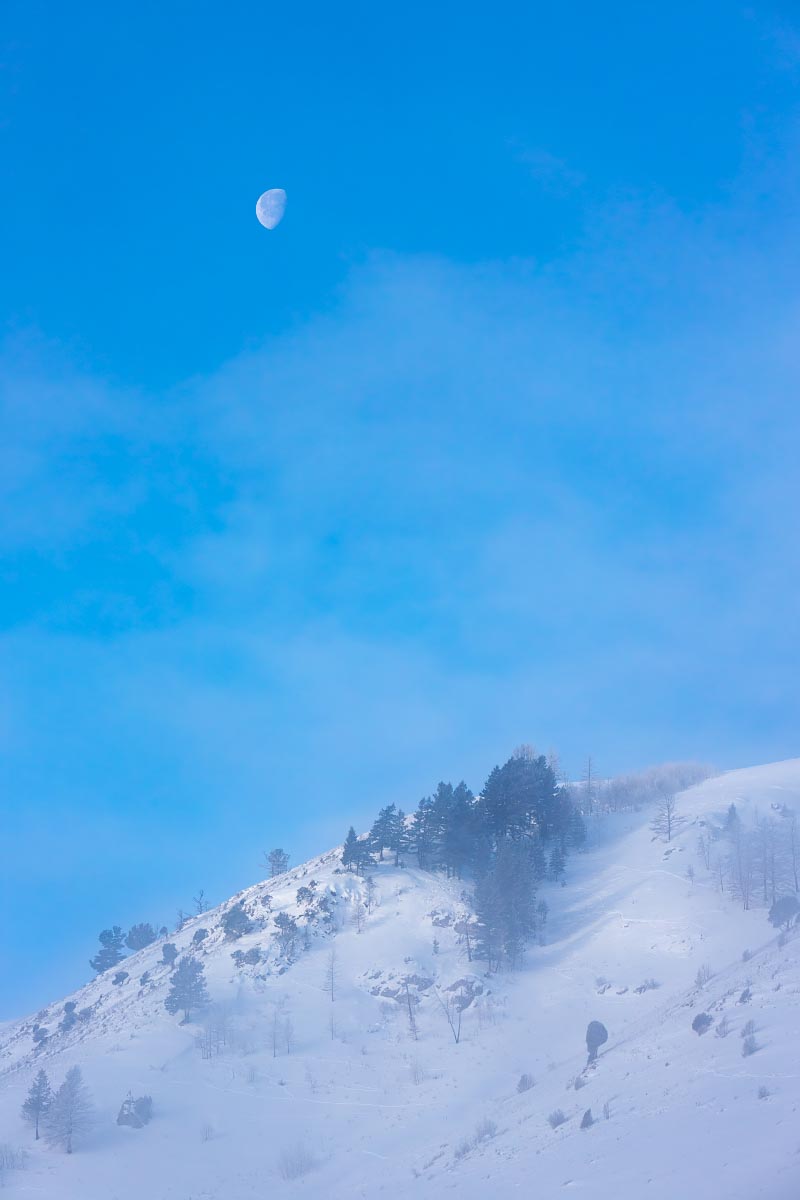
Frosty hillside above Jackson
March 2022
While this is titled my Wyoming blog, the next 60+ photos are from Utah. At the end of March we were finally able to take our first one week vacation in seven years and decided to go to Moab, Utah to see 2 National Parks and a lot of other fantastic sights in that area.
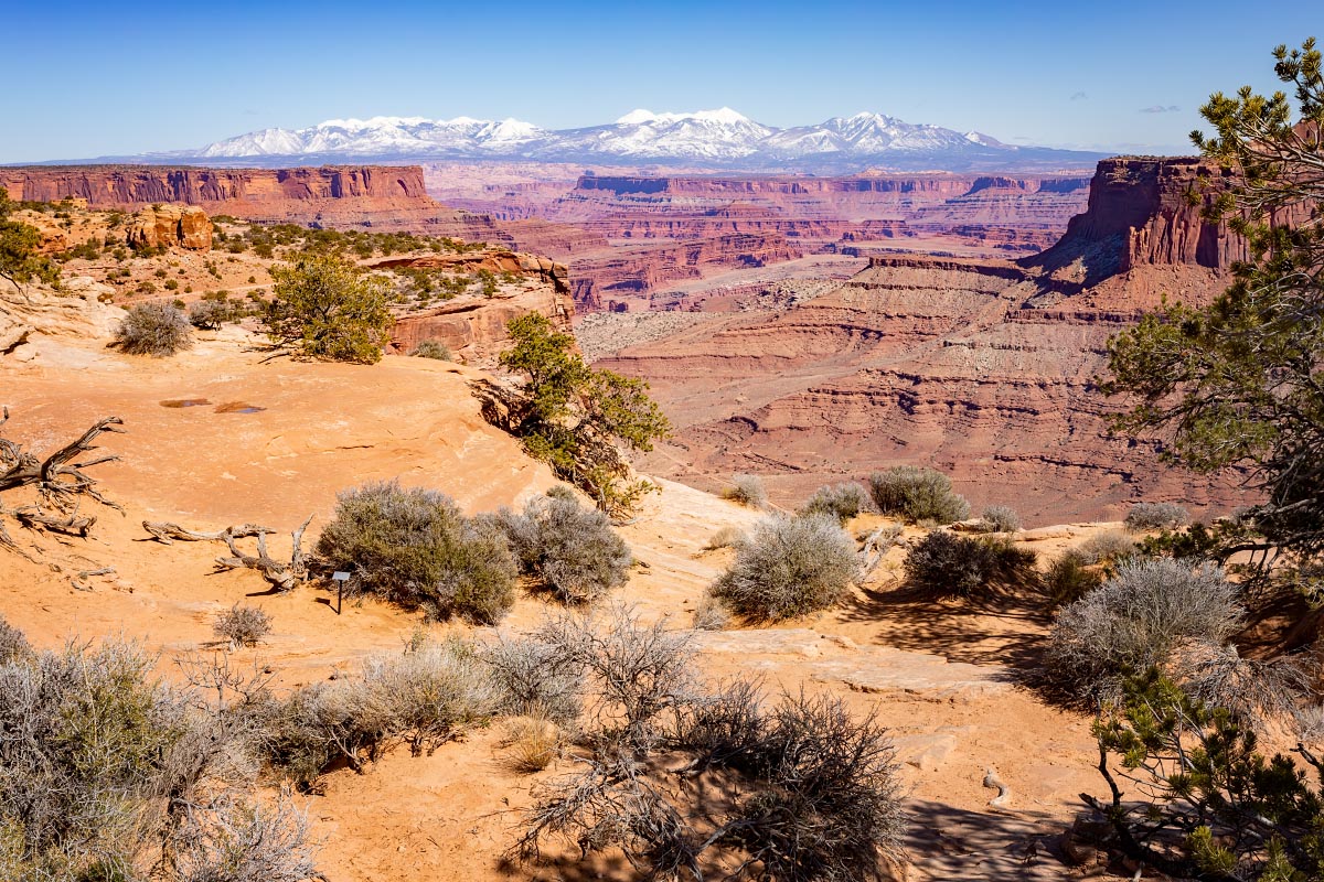
Canyonlands National Park: The Green River from Wyoming joins the Colorado River dividing the park into three sections. The northernmost section is called Island in the Sky. The southeast section is The Needles. The southwest corner is The Maze and is mostly inaccessible except for long multi-day backpacking trips.
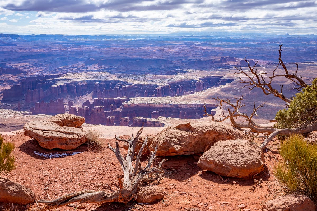
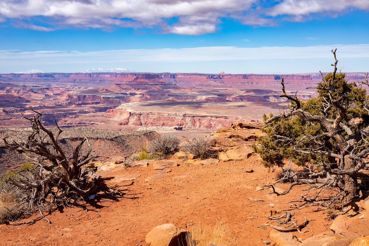
3/21/22: Canyonlands – Island in the Sky. The road here climbs to the top of an enormous mesa over 1000 feet above the surrounding terrain, thus giving rise (as it were) to its name. Also, every viewpoint shows clearly why this whole area is called Canyonlands.
First up, the Green River Overlook.
Green River Overlook
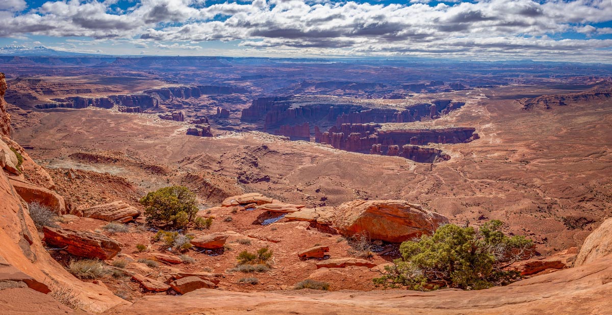
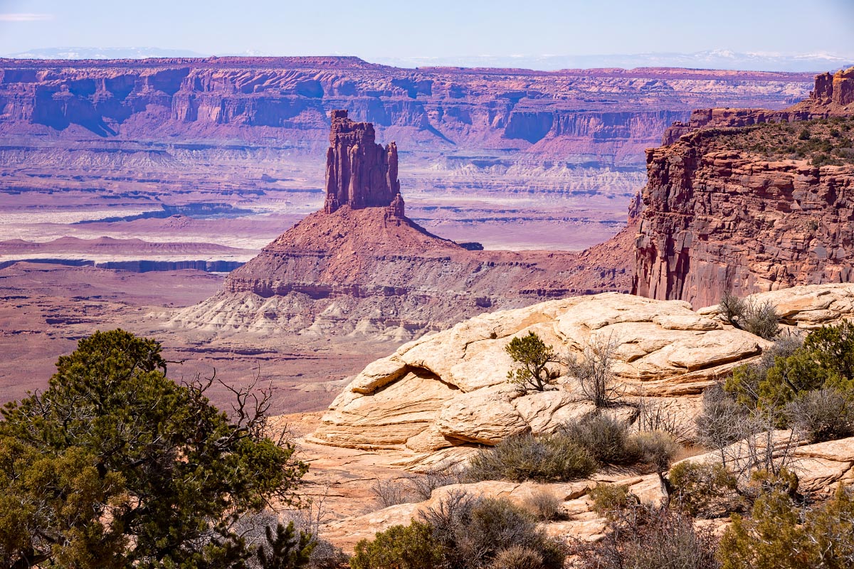
Along the trail to Grand View Overlook is probably the iconic Canyonlands view of finger-like canyons of massive proportions, difficult to demonstrate in a photo.
Canyonlands
Canyonlands
Grand View Point
Grand View Point
Grand View Point
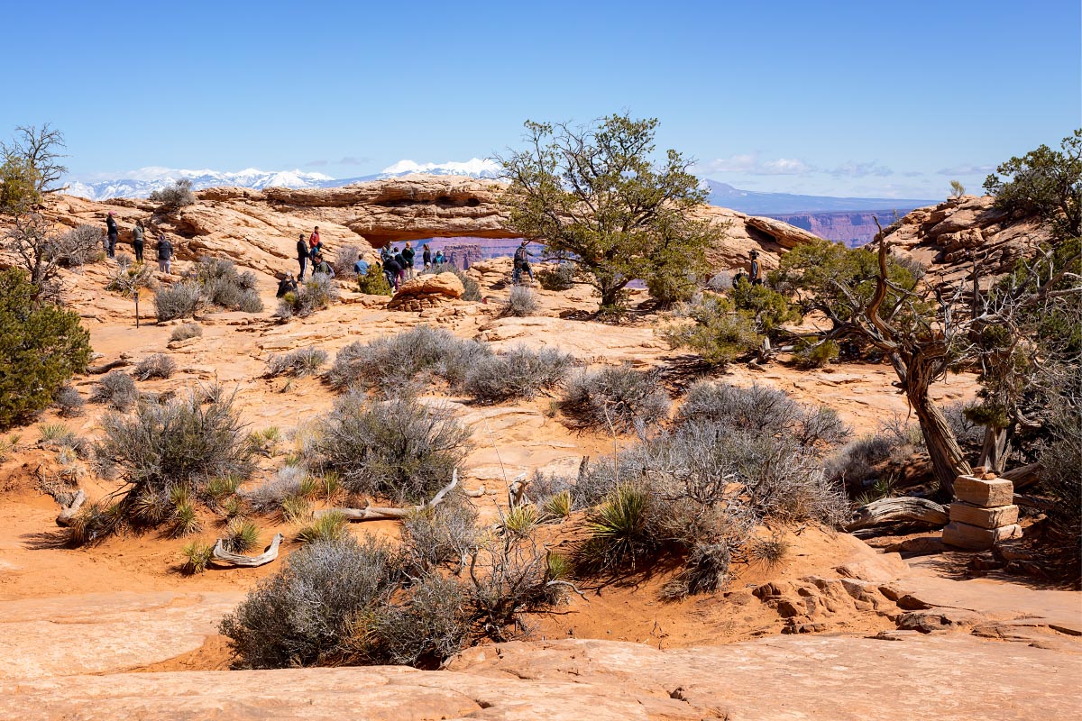
Generally I like to keep people out of my scenic photos, but the park is very crowded. While I could have “Photoshopped out” the people, I’ve tended to leave them in for this trip to demonstrate the size of some of these arches.
This is Mesa arch which is actually quite small compared to the ones we will be seeing shortly in Arches National Park.
Mesa Arch
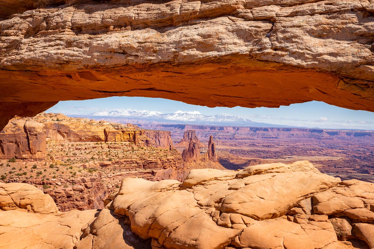
While it is not the most spectacular arch, what has made this arch extremely famous are the photographs taken through the arch with the canyons below and the La Sal Mountains in the distance.
Mesa Arch
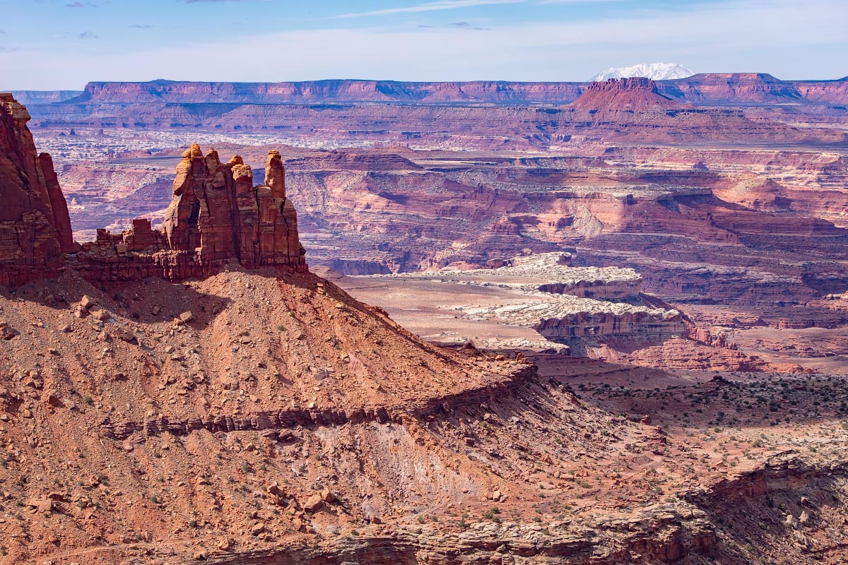
Candlestick Tower Overlook
Candlestick Tower
The view from the Visitor Center
Canyonlands
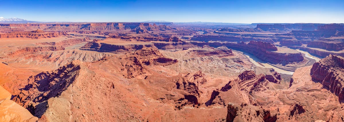
Anywhere else this would be a national park, but this view of the Colorado River Canyon is from Dead Horse Point State Park.
Dead Horse Point State Park
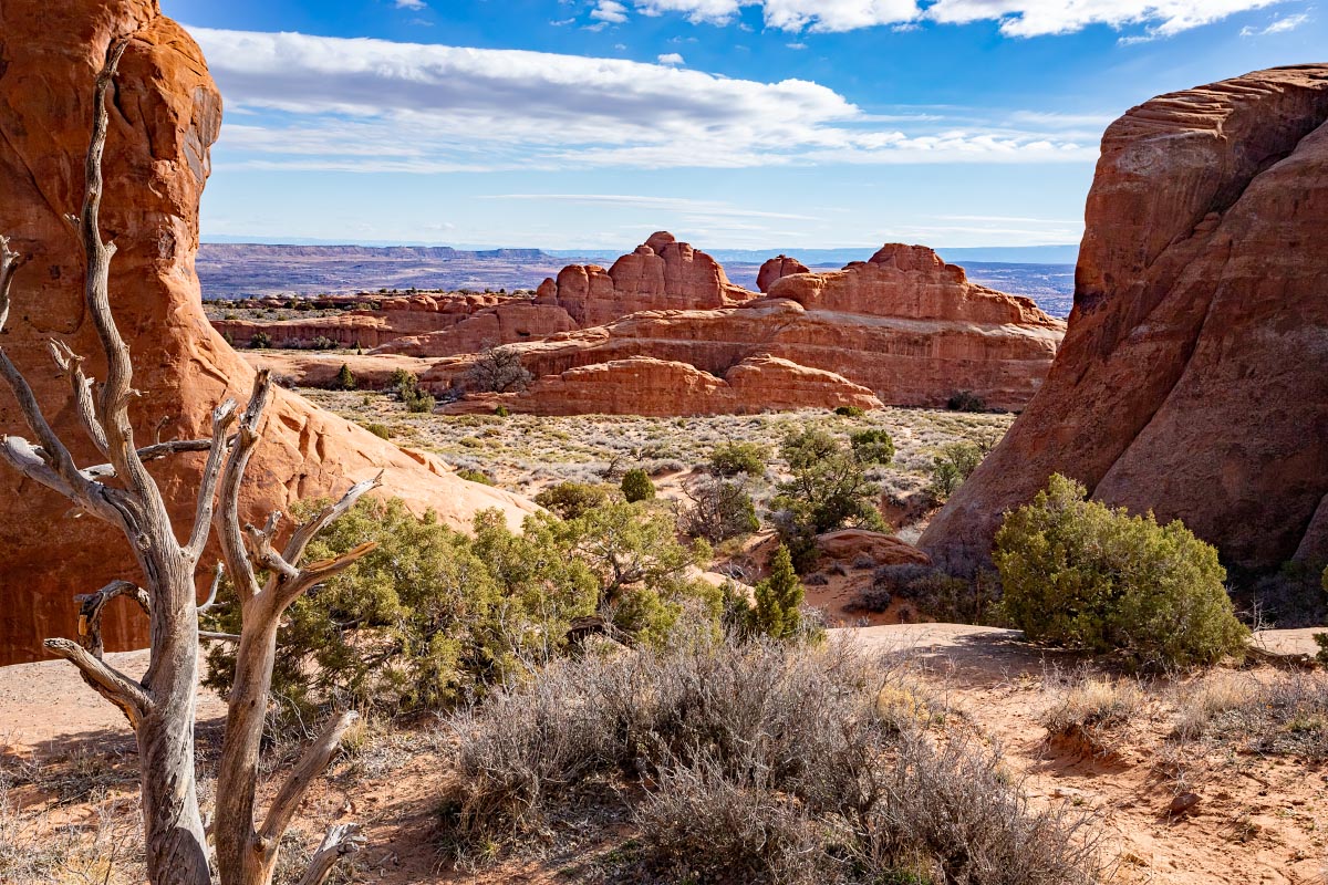
3/22/22: Arches National Park: This park is rapidly becoming one of the most crowded parks in the country, and starting in April has gone to a reservation based timed entry system. When we were there, the park gates usually closed by 9 AM because of too many cars for the parking areas.
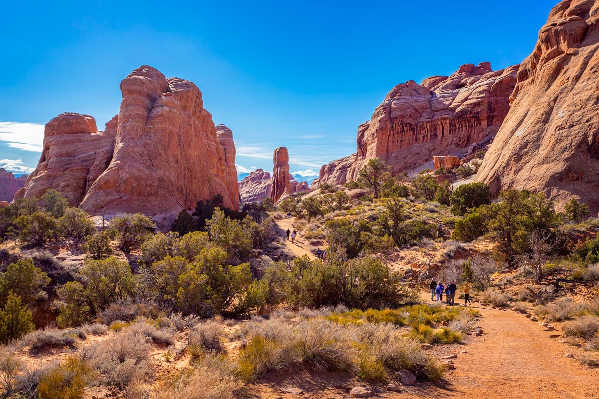
On our first day there, we all decided we would drive to the very northernmost end of the park for the Landscape Arch hike. It proved to be a good decision because we were able to get a parking spot quite easily.
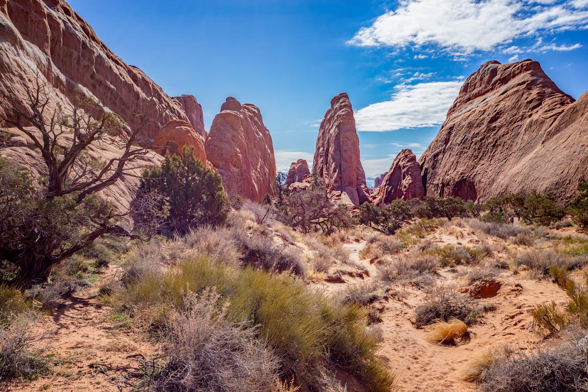
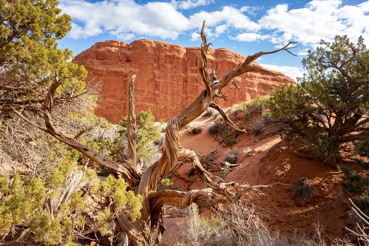
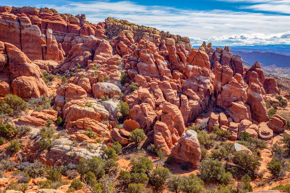
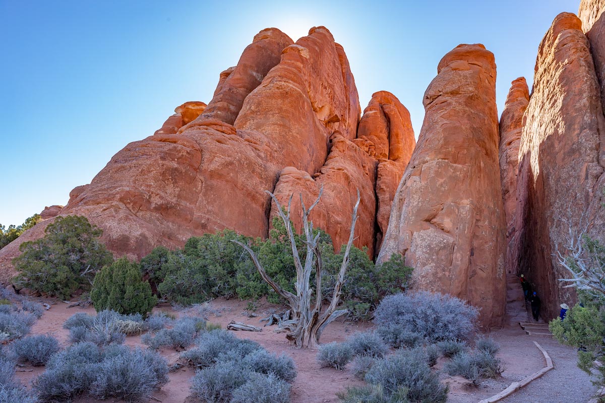
Scenery along the hike: in many areas of the park erosion has caused the red rock to form these massive “fins“.
Landscape Arch trail
Again, people left in for scale.
Landscape Arch trail
Landscape Arch trail
Landscape Arch trail
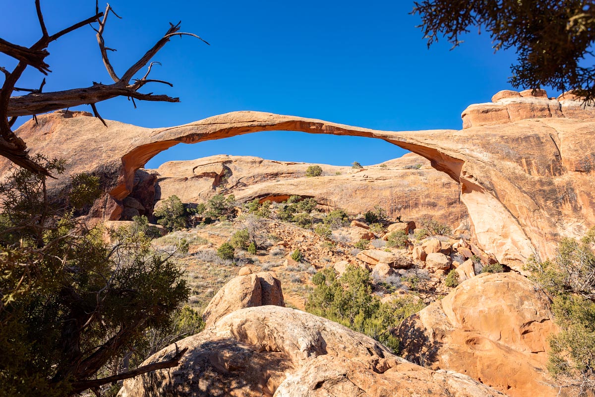
Landscape Arch’s 306 foot span is most likely the longest arch in the world. It is only 11 feet thick at its narrowest point. It is thought that it could collapse “any day” now in geologic terms (i.e. sometime in the next few thousand years).
Landscape Arch
2 other arches were along this trail. Here is the beautiful Pine Tree Arch.
Pine Tree Arch
Pine Tree Arch
Tunnel Arch
Tunnel Arch
Leaving the Landscape Arch area, this is Fiery Furnace.
Fiery Furnace
Garden of Eden
Garden of Eden
Garden of Eden
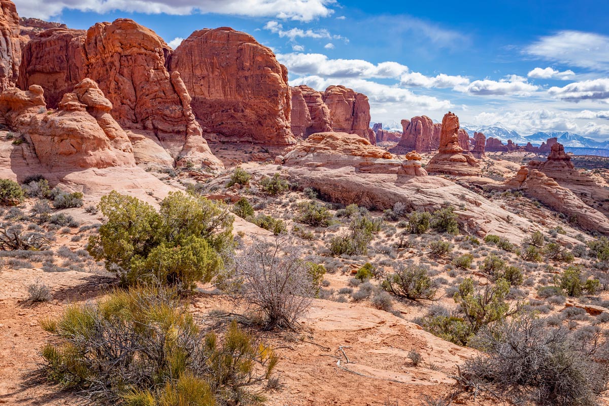
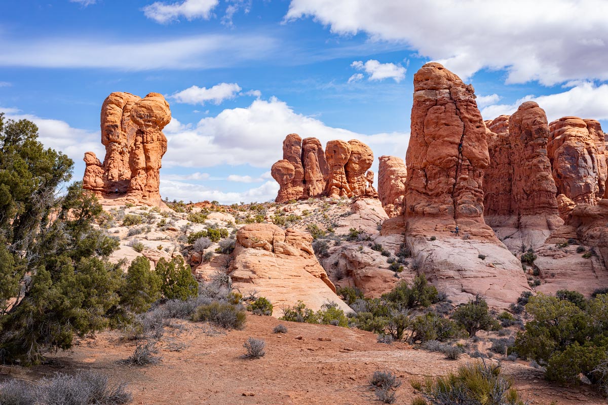
“The Windows” area has 4 fantastic arches.
This is the Parade of Elephants on the way to Double Arch.
Parade of Elephants
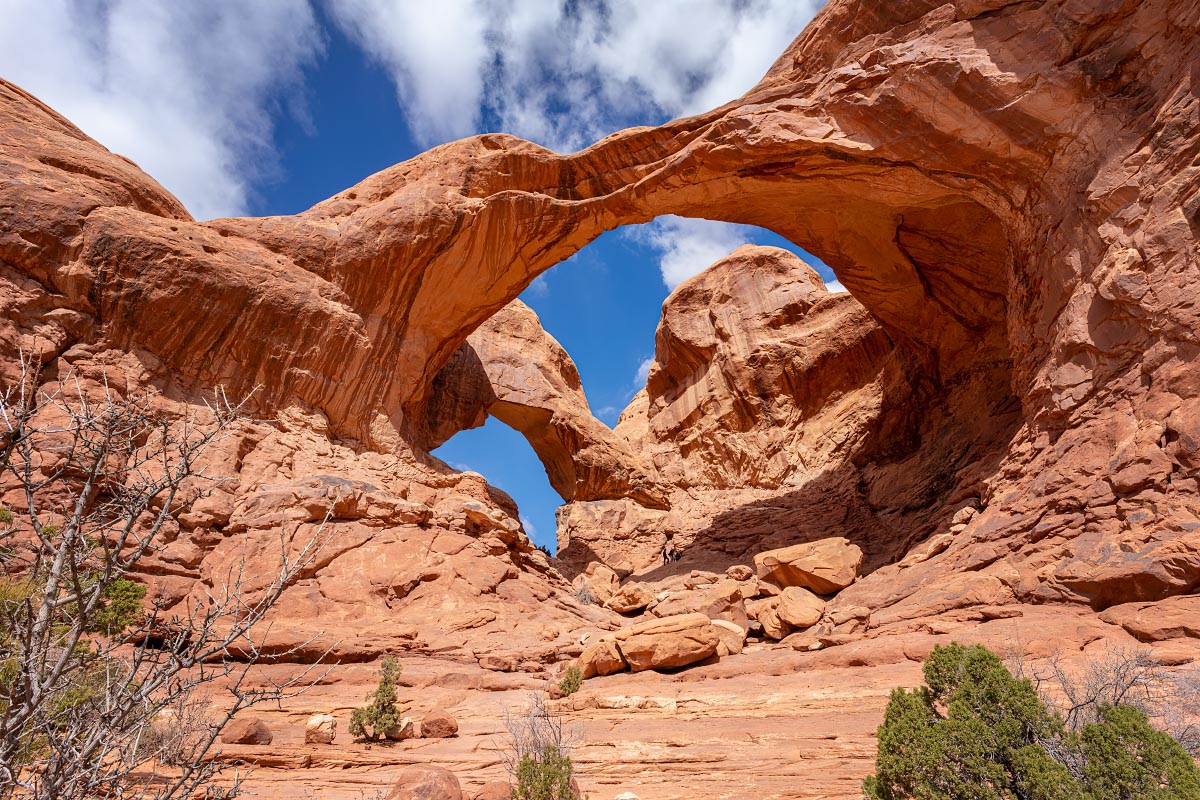
I thought Double Arch was magnificent. If you can spot the few people in the middle, you may be able to appreciate its massive size.
Double Arch
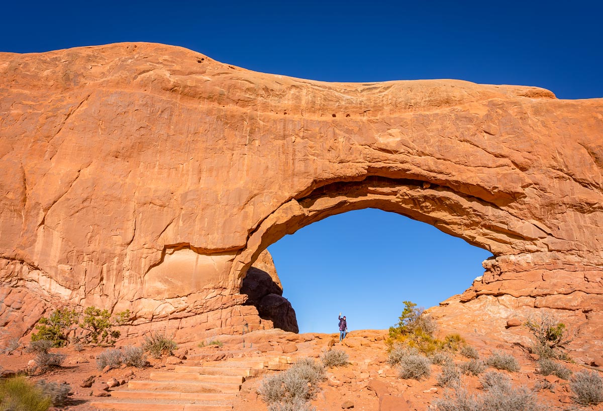
This is North Window with Katherine waving at the camera.
North Window
South Window
South Window
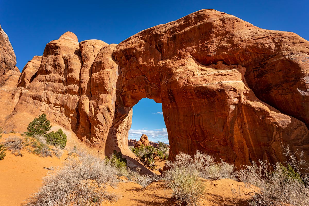
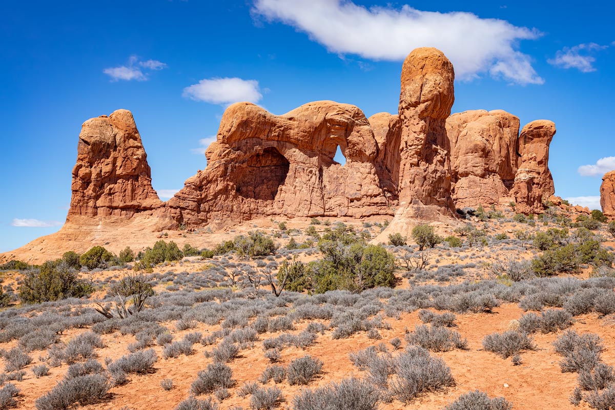
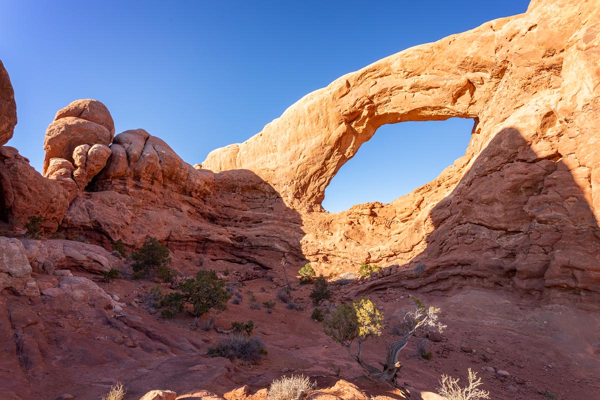
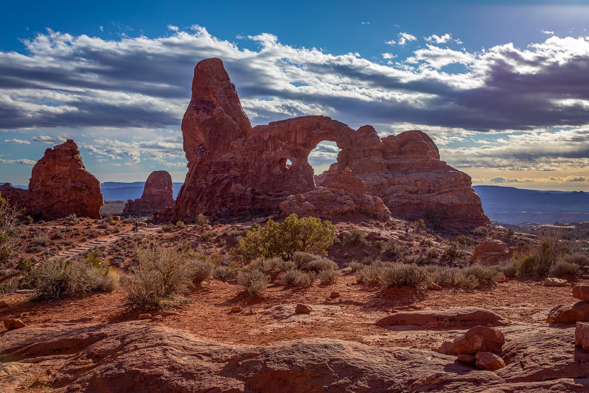
From The Windows, we could look back at Turret Arch.
Turret Arch
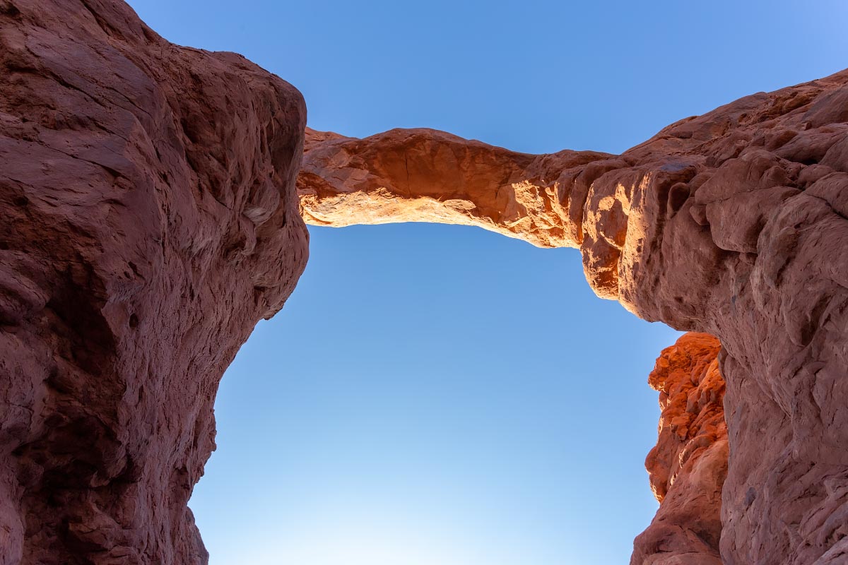
We could actually climb through the opening of Turret Arch, and this is looking straight up.
Turret Arch
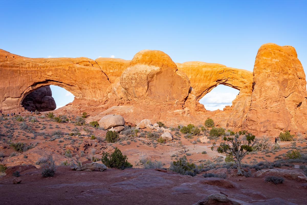
Looking back from Turret Arch, we could see both of The Windows at one time. One can see why some call them The Spectacles.
The Windows
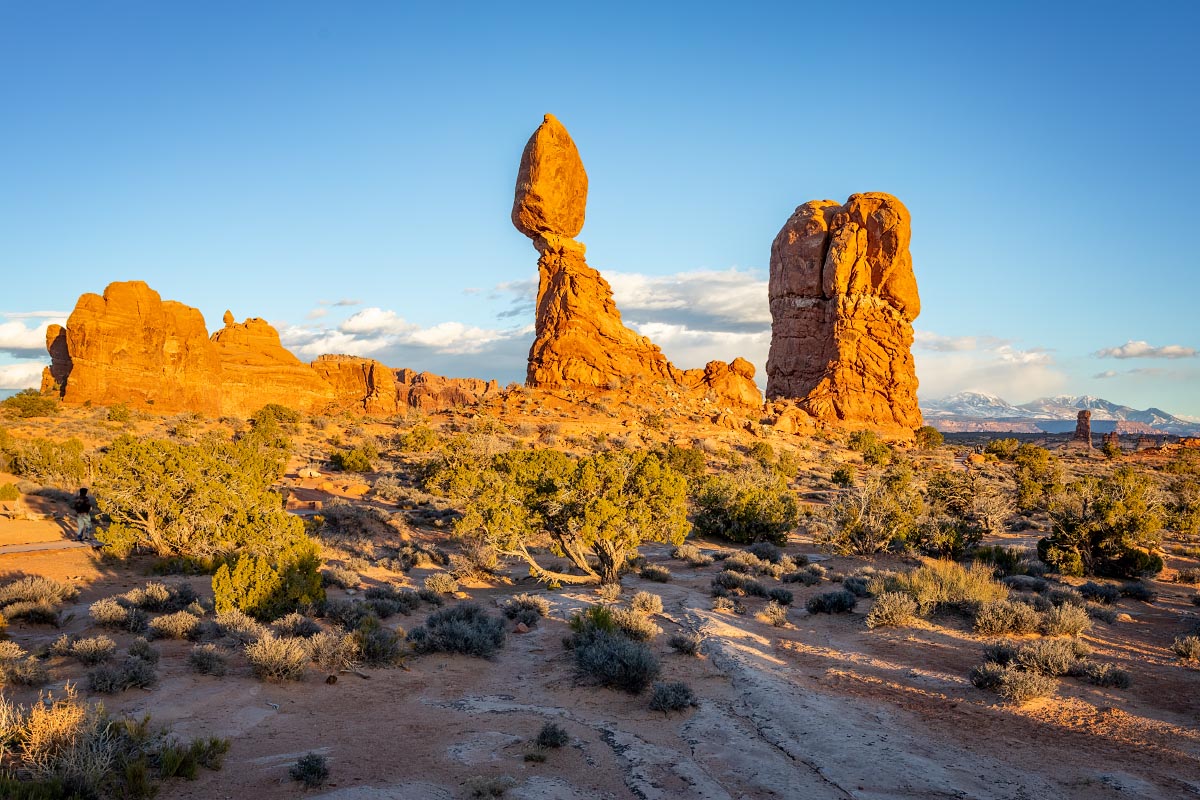
Balanced Rock at sunset
Balanced Rock
Petrified Dunes: 200 million years ago there was a vast desert here. Over time the sand drifts were covered by other layers of sediment, compressed and cemented by quartz and calcite into Navajo Sandstone. Erosion has since washed away overlying layers, exposing the original dune-scape.
Petrified Dunes
3/23/22: Day 2 at Arches.
As soon as you enter the park there are massive monoliths everywhere you look. Many of them have been named. First stop is at what is know as Park Avenue. Many of these “skyscrapers” are 600 feet tall. Quite a few of them have been named, but the only one I know for sure is at the far left (where it looks like the top rock has shifted and is just balancing there) is known as Queen Nefertiti.
Park Avenue
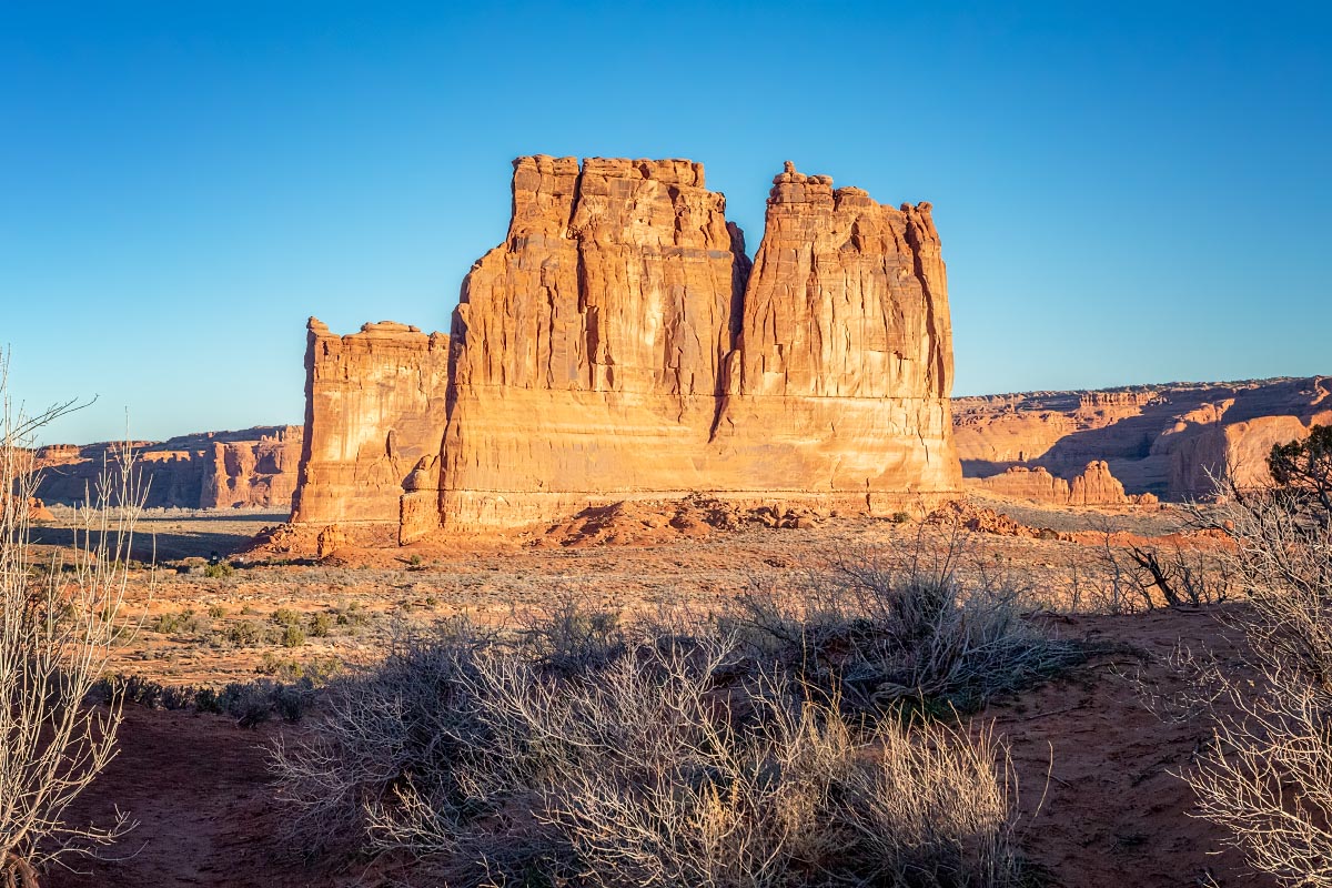
Along the main road there are many more named monoliths. I believe all of them together are known as The Courthouse Towers, with specific named structures…
The Organ
The Organ
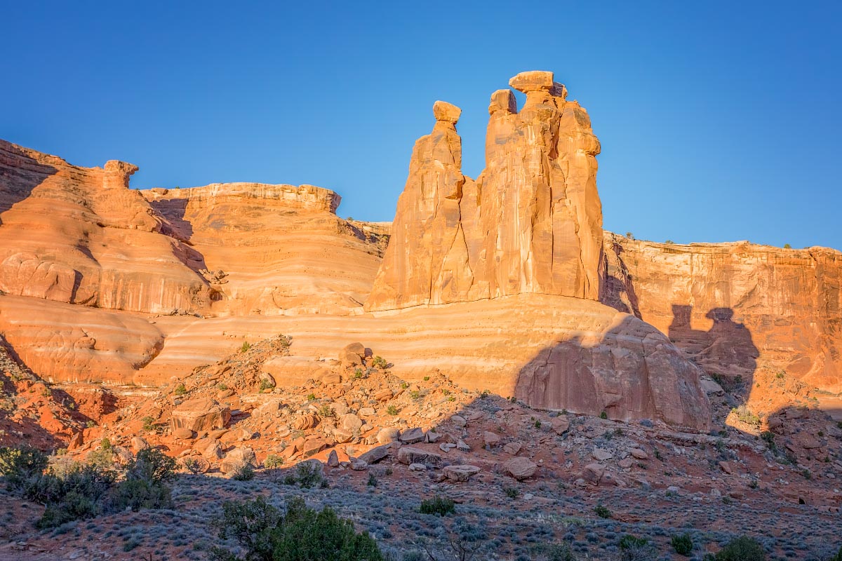
The Three Gossips
The 3 Gossips
Sheep Rock
Sheep Rock
The Tower of Babel
The Tower of Babel
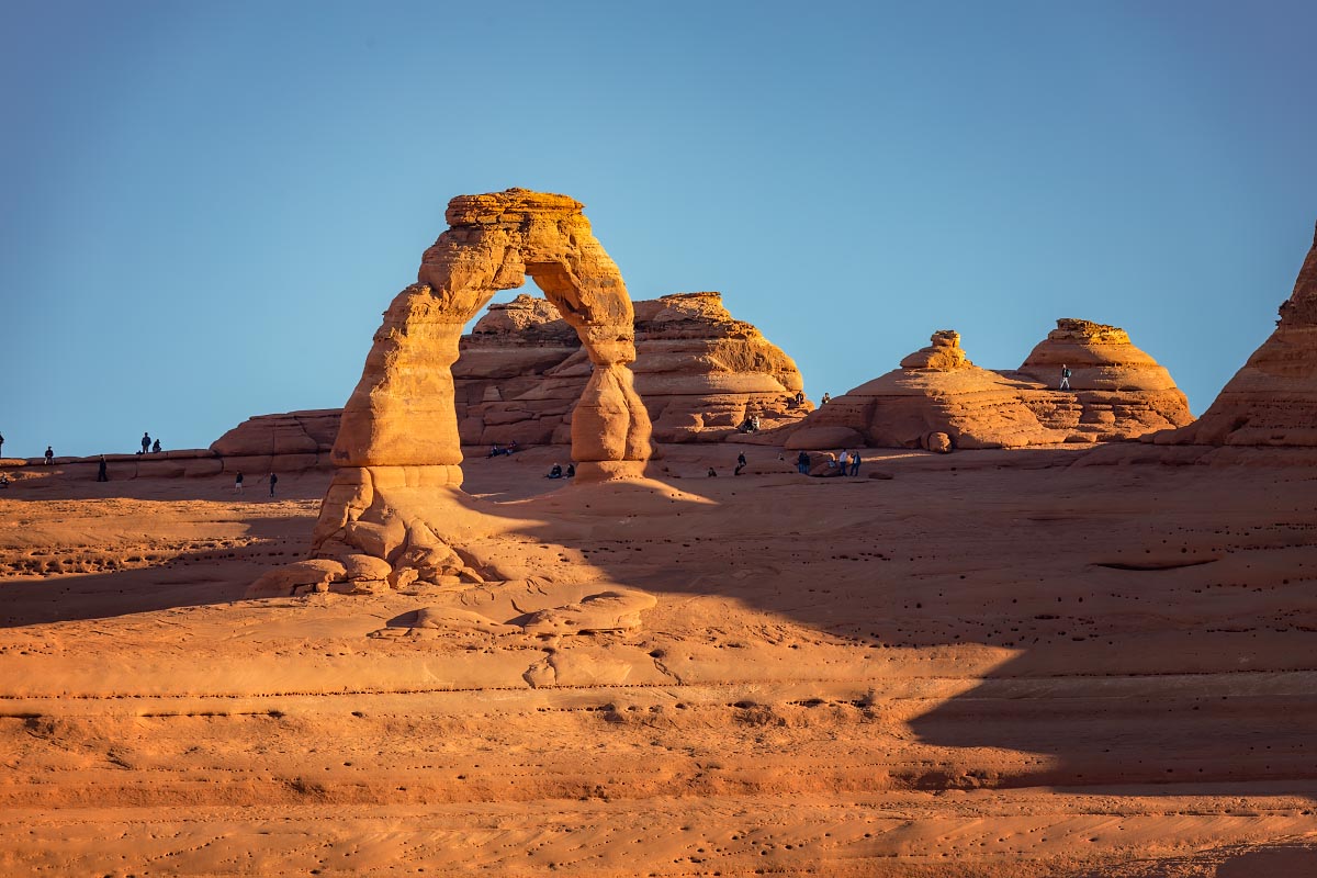
The most famous hike in Arches National Park is to Delicate Arch. We had already decided that we may not do the long hike, and the completely full parking lot helped make that decision final. We did do a shorter hike to an overlook where we could see the arch from a distance.
Delicate Arch
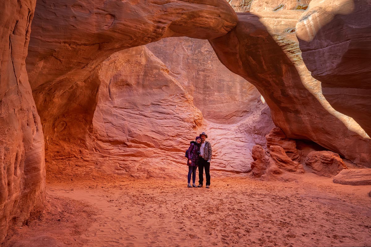
One of our favorite places ended up being Sand Dune Arch. A very short hike was quite fun, hiking on soft sand through narrow passages between these giant red rock fins.
Sand Dune Arch Trail
Sand Dune Arch with Katherine and Jackson graciously posing for scale.
Sand Dune Arch
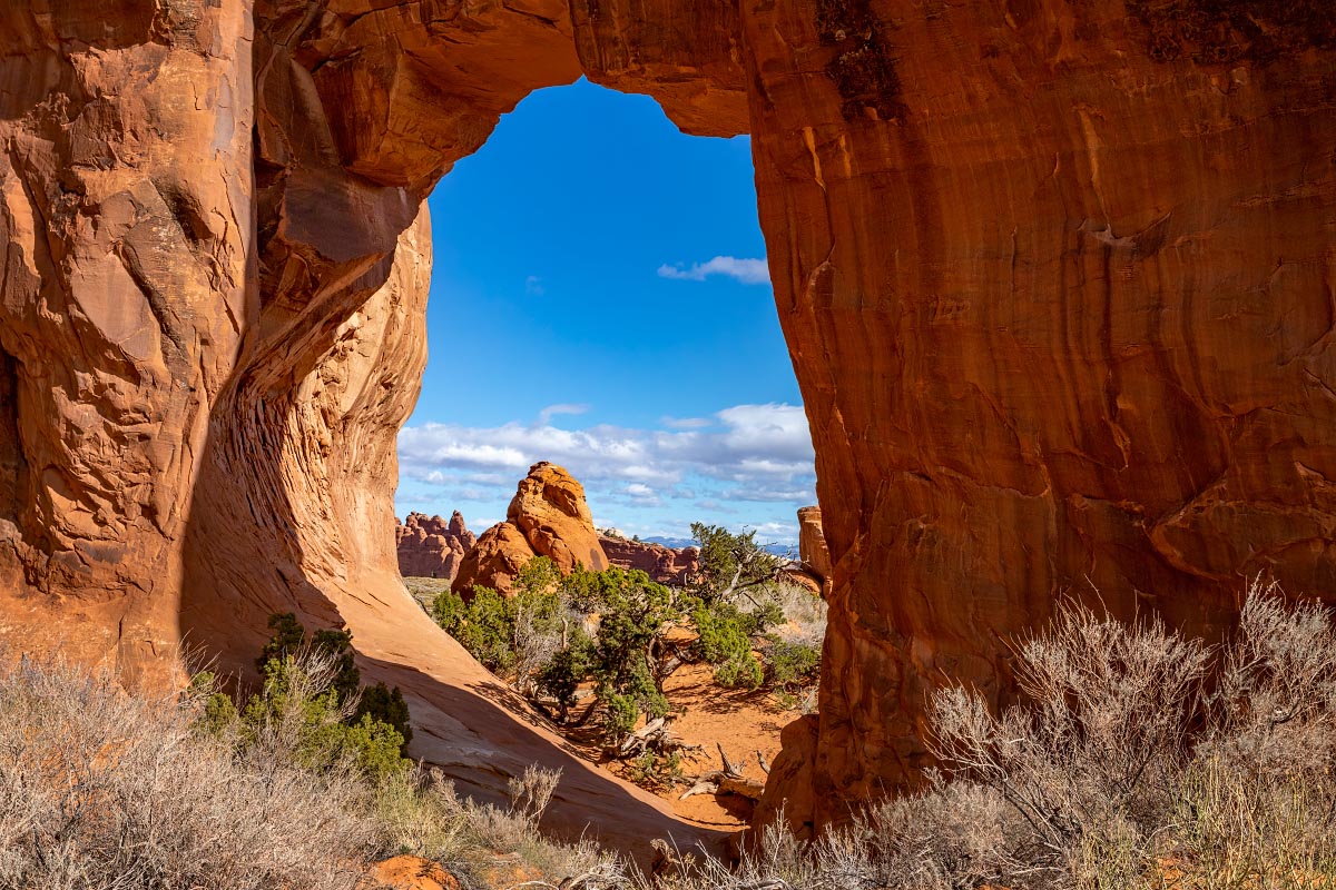
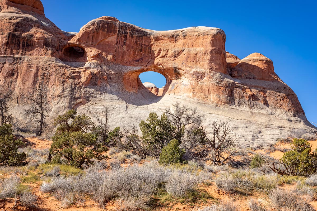
While skyline arch is visible from the main road, an interesting historical fact made us want to hike all the way to the bottom. In 1940 a massive boulder fell out of the opening of the arch effectively doubling the size of the arch opening.
Skyline Arch
After hiking around the large fin at the base of the arch, we found the boulder debris on the ground below.
Skyline Arch
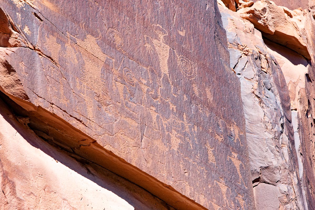
Leaving the park, we went on a search for ancient Native American petroglyphs. There is an area of very well preserved petroglyphs just a few miles outside of the park.
Petroglyphs
Petroglyphs
Petroglyphs
Petroglyphs
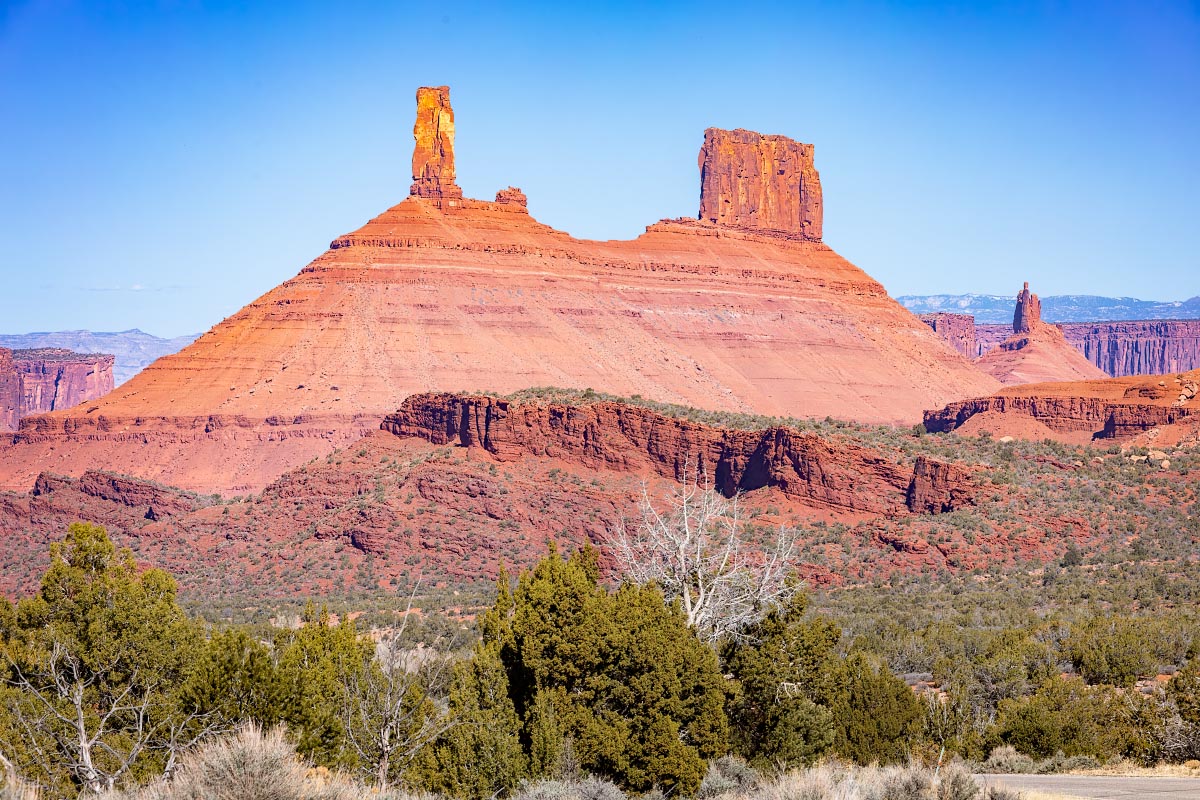
3/24/22: Drove the La Sal Mountain Loop Road to get away from the crowds. Coming down from the mountains, the road takes us into Castle Valley. The thin rock tower on the left is Castleton Tower. Apparently it’s been used as a backdrop in many old westerns.
Castleton Tower
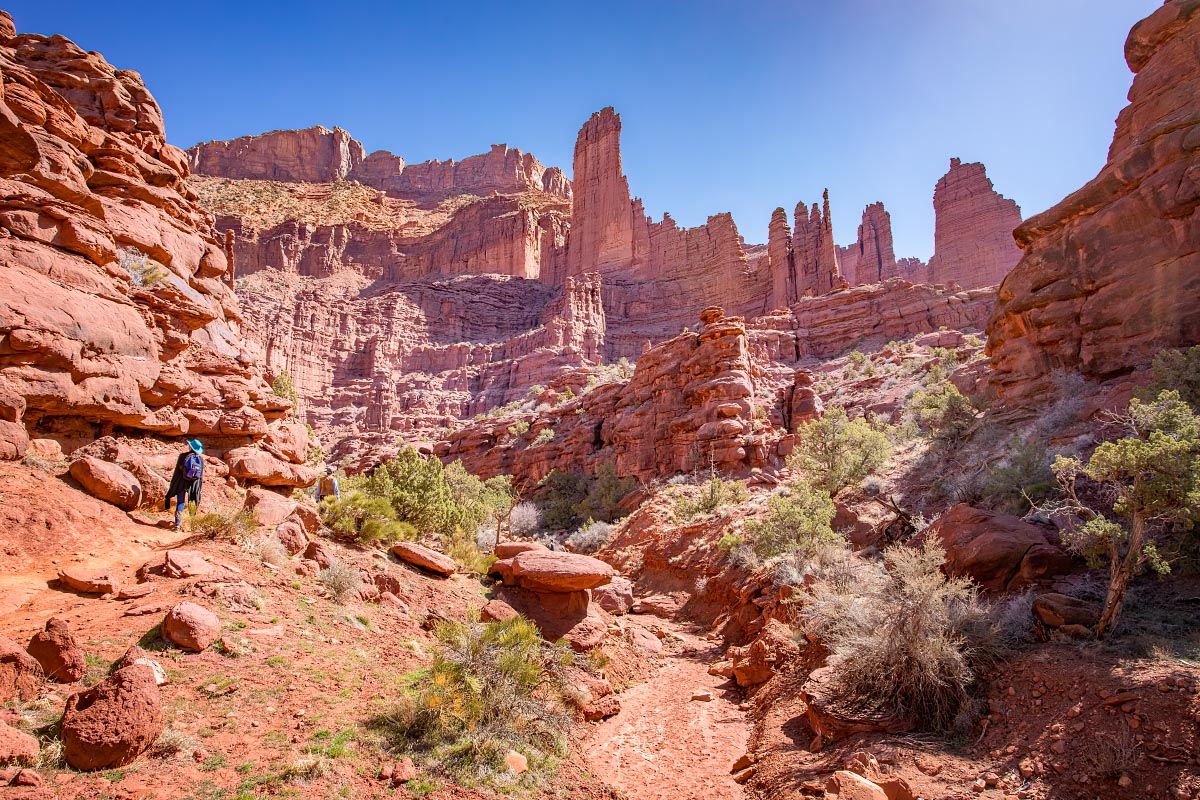
Next on my to do list was Fisher Towers. It was getting hot and the hike was somewhat difficult, so we did not finish the trail. Also, photography was difficult shooting up directly at the sun. However, I thought this was one of the more spectacular vistas of the week.
Fisher Towers
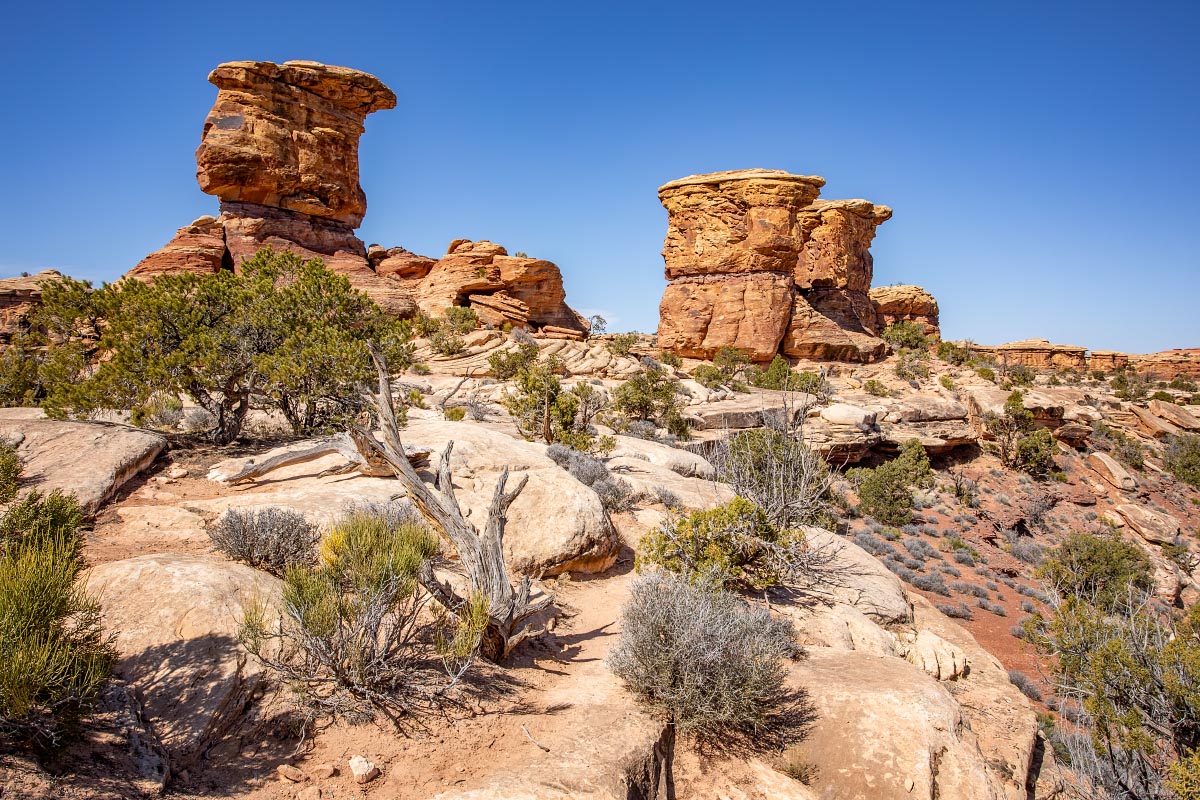
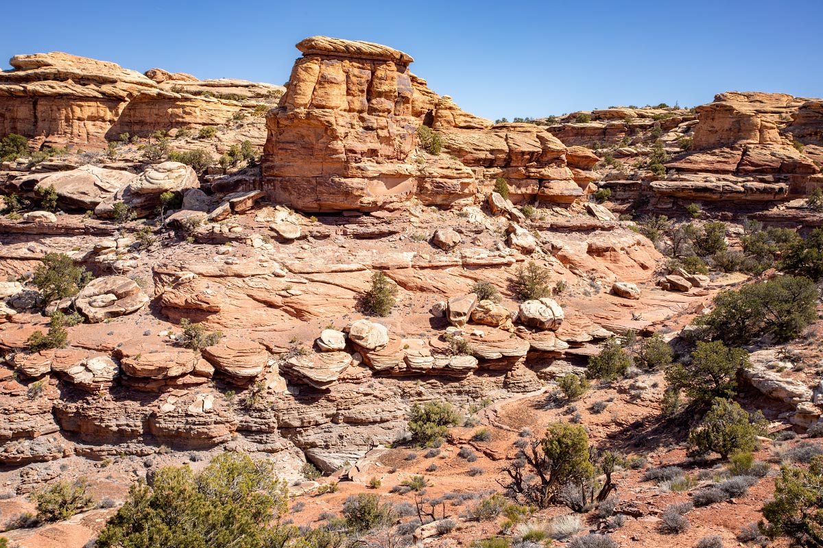
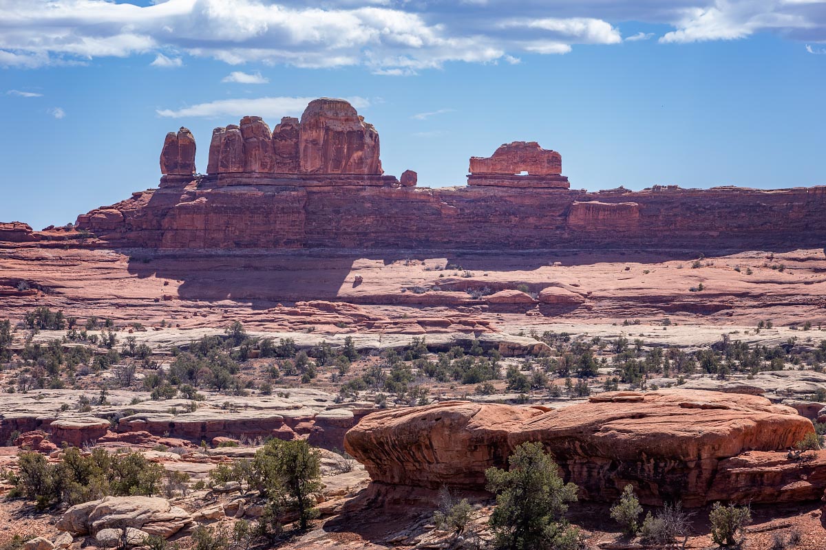
3/25/22: Canyonlands: The Needles. This much less crowded part of Canyonlands National Park was quite fun and interesting.
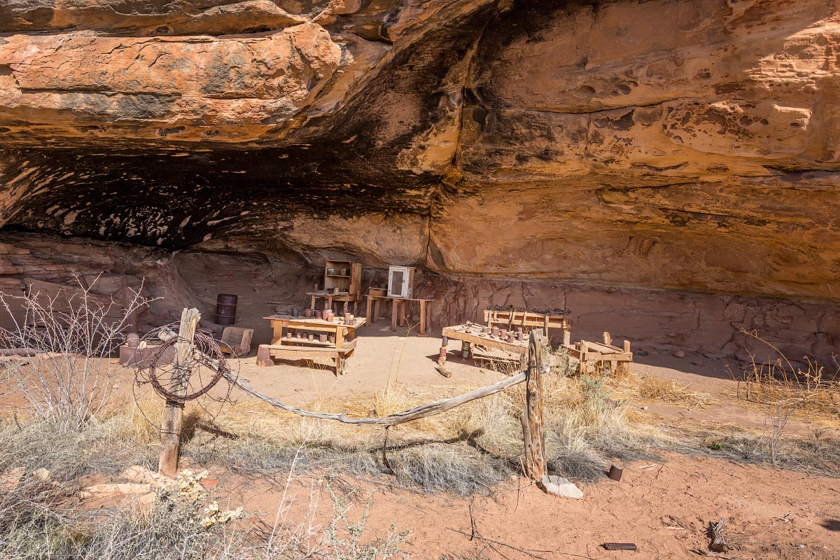
We started with Cave Spring Trail. There were numerous large rock overhangs that provided shade from the sun. First up was a 19th-century cowboy camp.
Cowboy camp
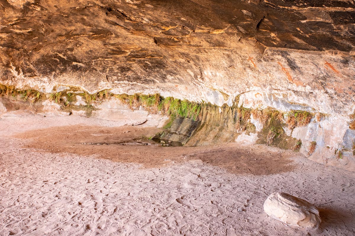
Next was the actual Cave Spring. The reason that the Native Americans and later the cowboys picked this area was because of a reliable water source. Rainwater percolates through the sandstone and forms these seeps where water collects and even maidenhair fern grows on the walls of the cave.
Cave Spring
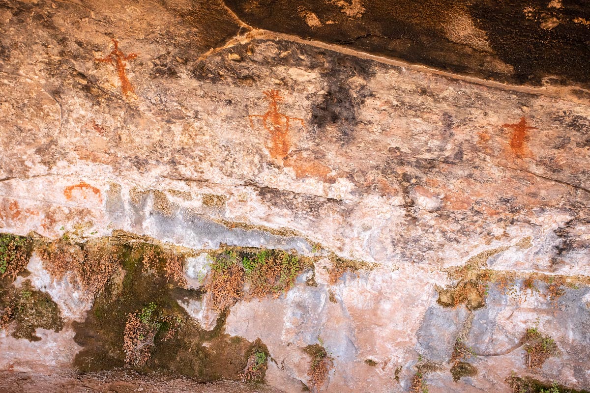
Native American pictographs above the water.
Pictographs
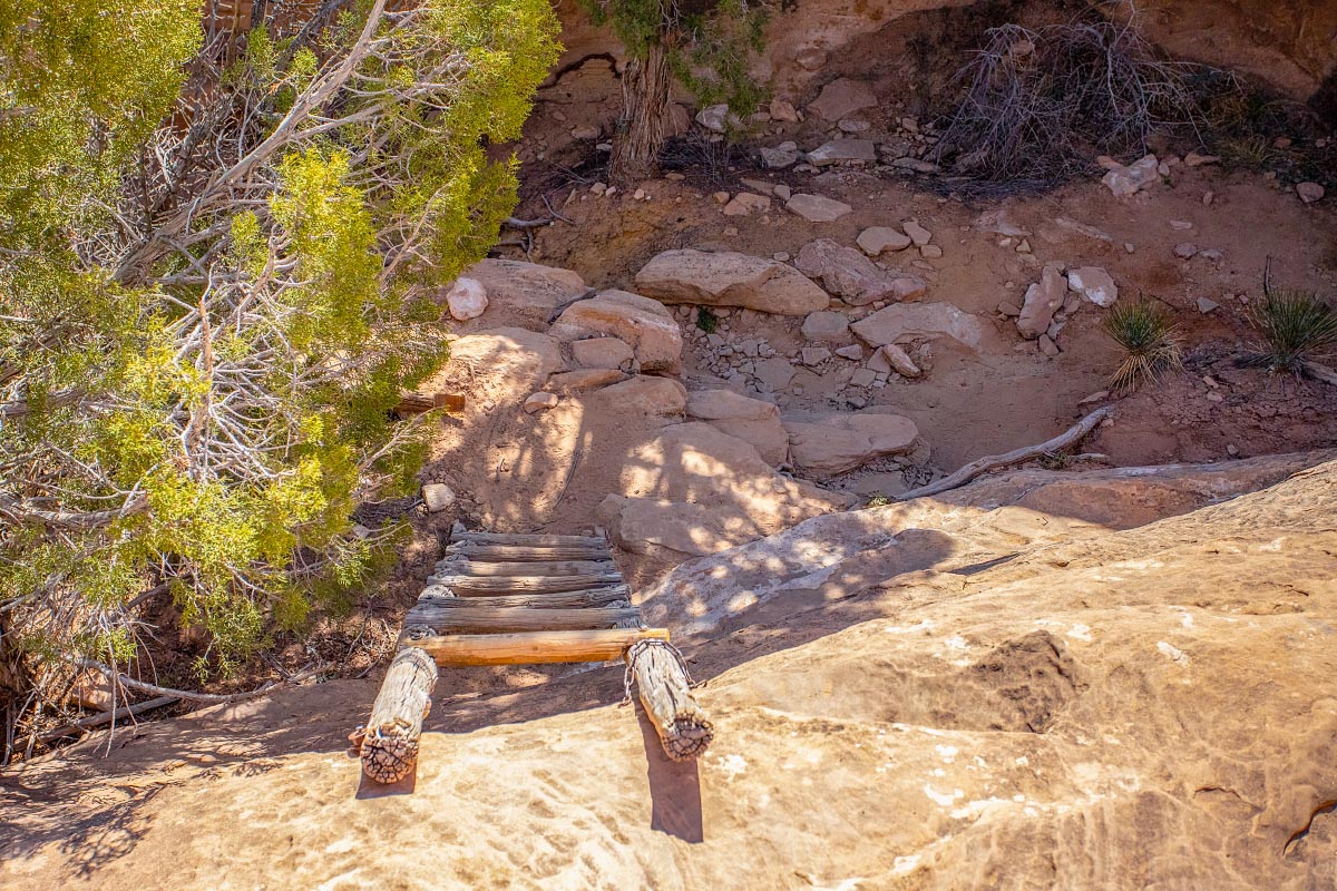
This was the first hiking trail we have ever been on that requires climbing 2 wooden ladders!
Cave Spring trail
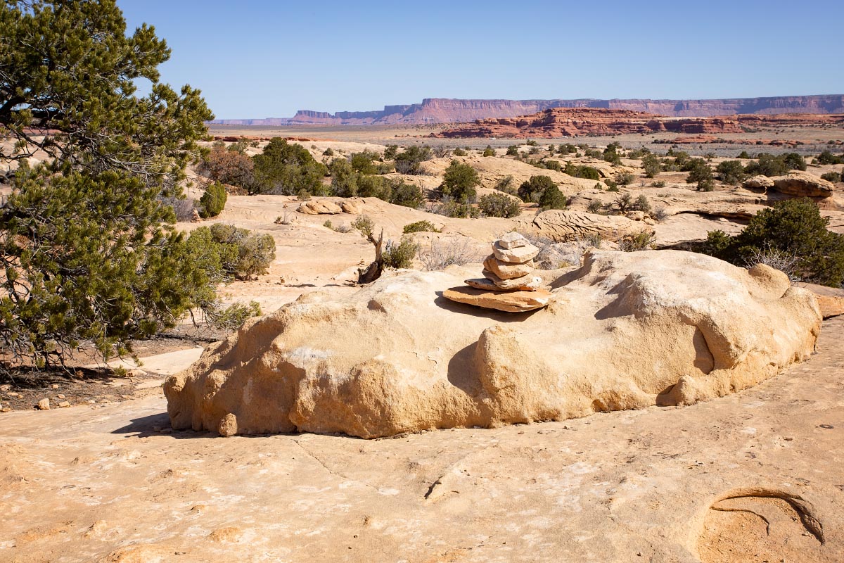
Once on top, you are hiking on what’s known as slickrock. Because there are no actual trails, you have to look ahead for these rock cairns to avoid getting lost.
Cave Spring trail
Another very short hike was to Big Spring Canyon.
Big Spring Canyon
Big Spring Canyon
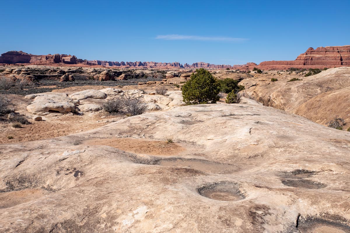
Pothole Point hike was fascinating. Potholes in the slickrock are generally completely dry. After a heavy rainfall, these fill with water and somehow these small ponds instantly spring to life. There are various forms of tiny shrimp and other animals that can tolerate almost complete loss of body water and then come back to life as quickly as 30 minutes after the pothole fills with rainwater.
Pothole Point
The view from the Pothole Point shows the namesake of this section of Canyonlands.
The Needles
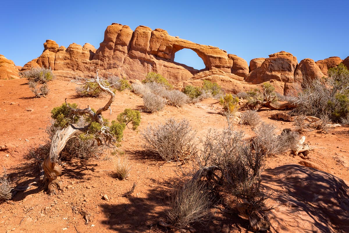
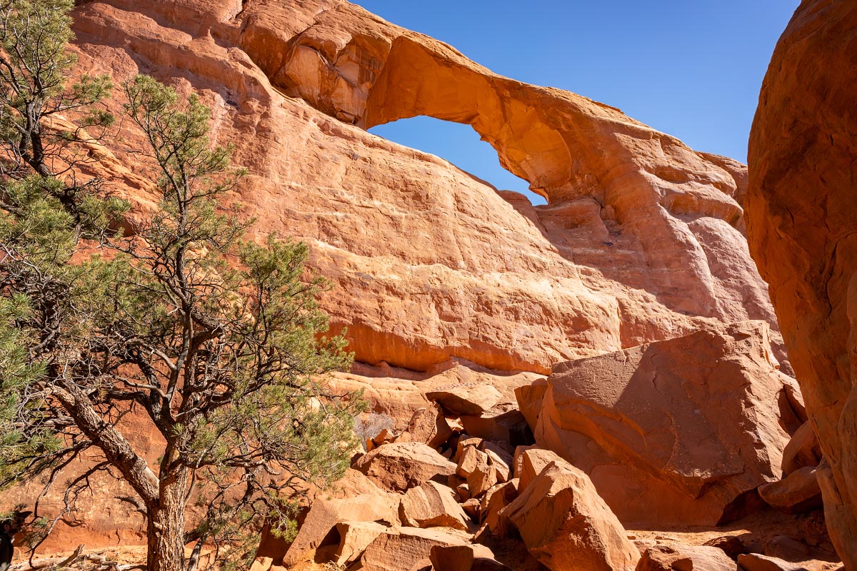
Wooden Shoe Arch
Wooden Shoe Arch
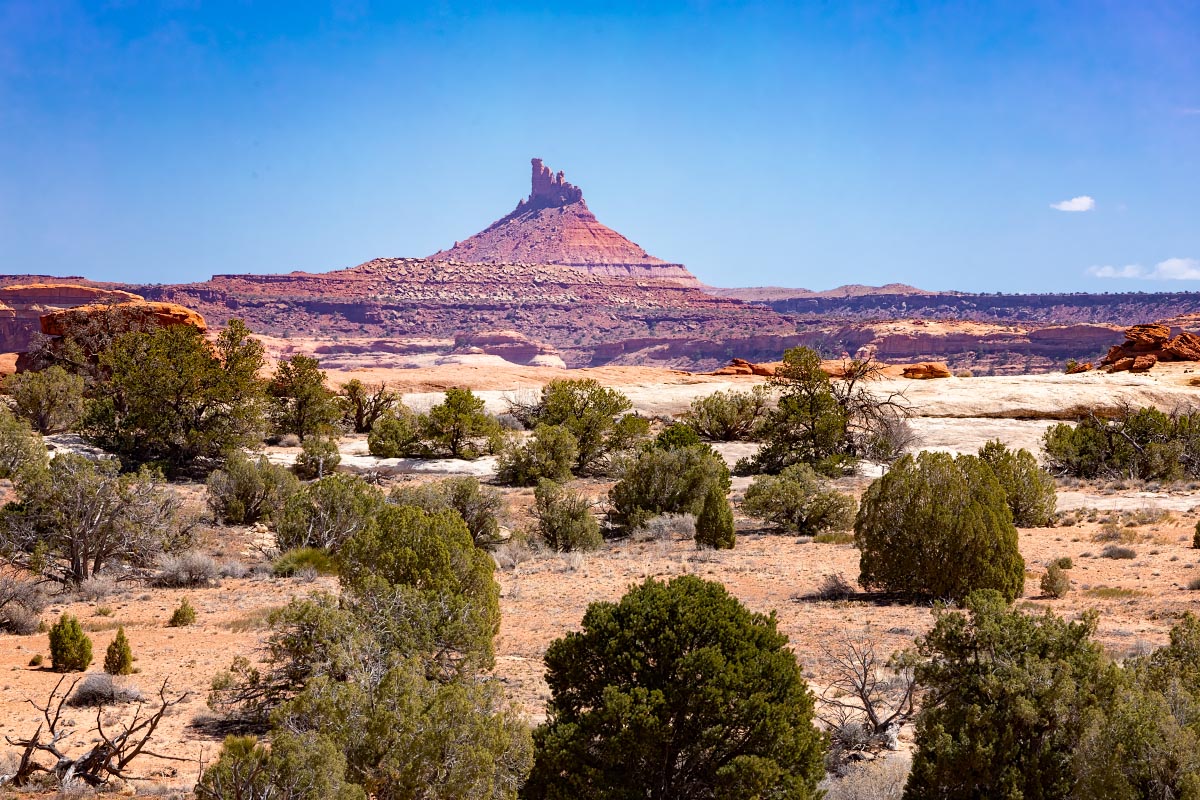
North Six-shooter Peak
North Six-shooter Peak
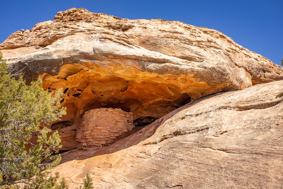
Difficult to judge scale here. No this is not a bird nest. This is an ancient stone Puebloan granary.
Puebloan granary
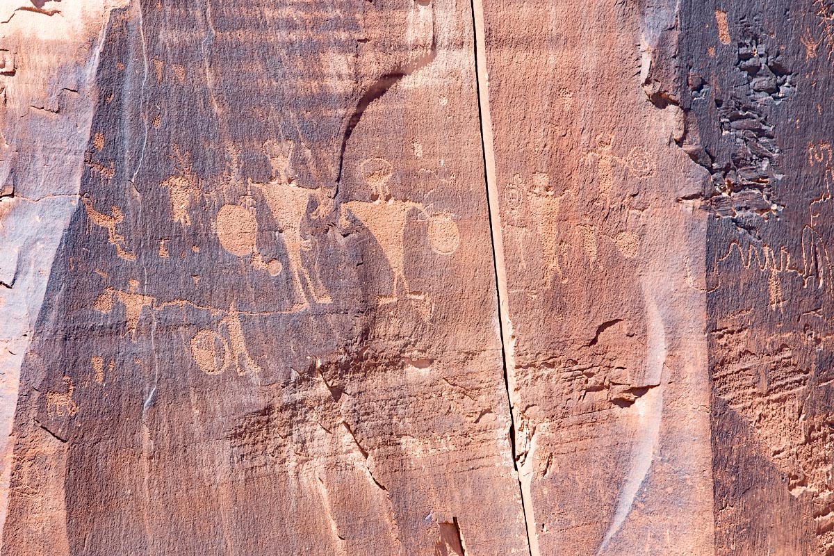
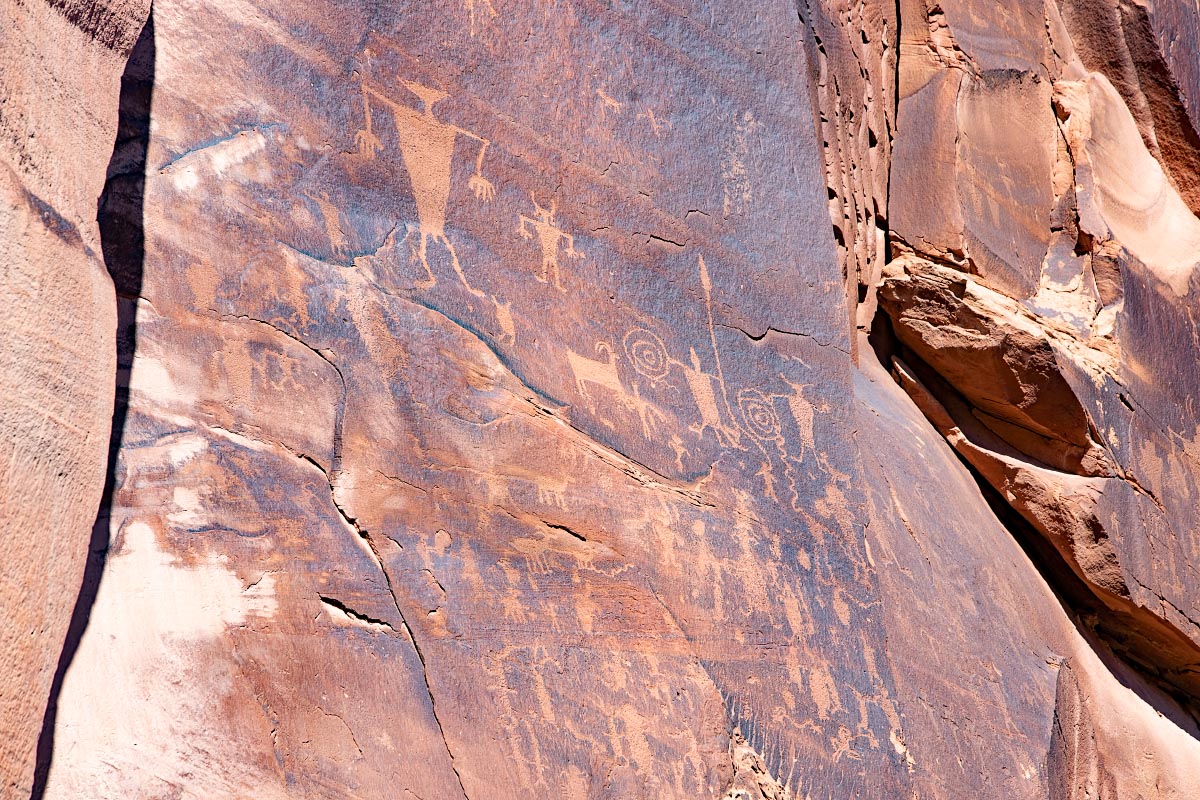
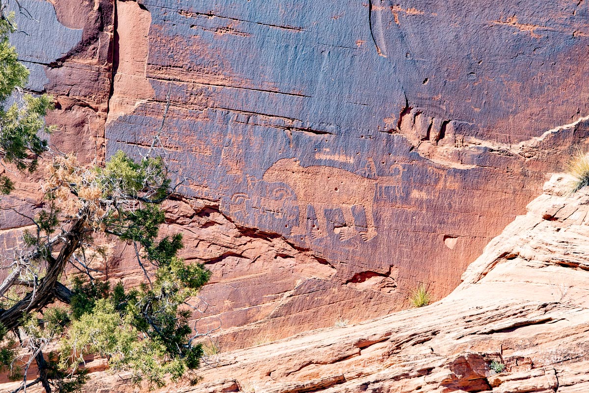
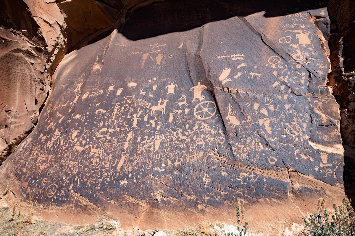
On the way out of The Needles, we stopped at Newspaper Rock-a very large wall filled with Native American petroglyphs.
Newspaper Rock
Not far from our condo was Wilson arch. It is visible from the main highway.
Wilson Arch
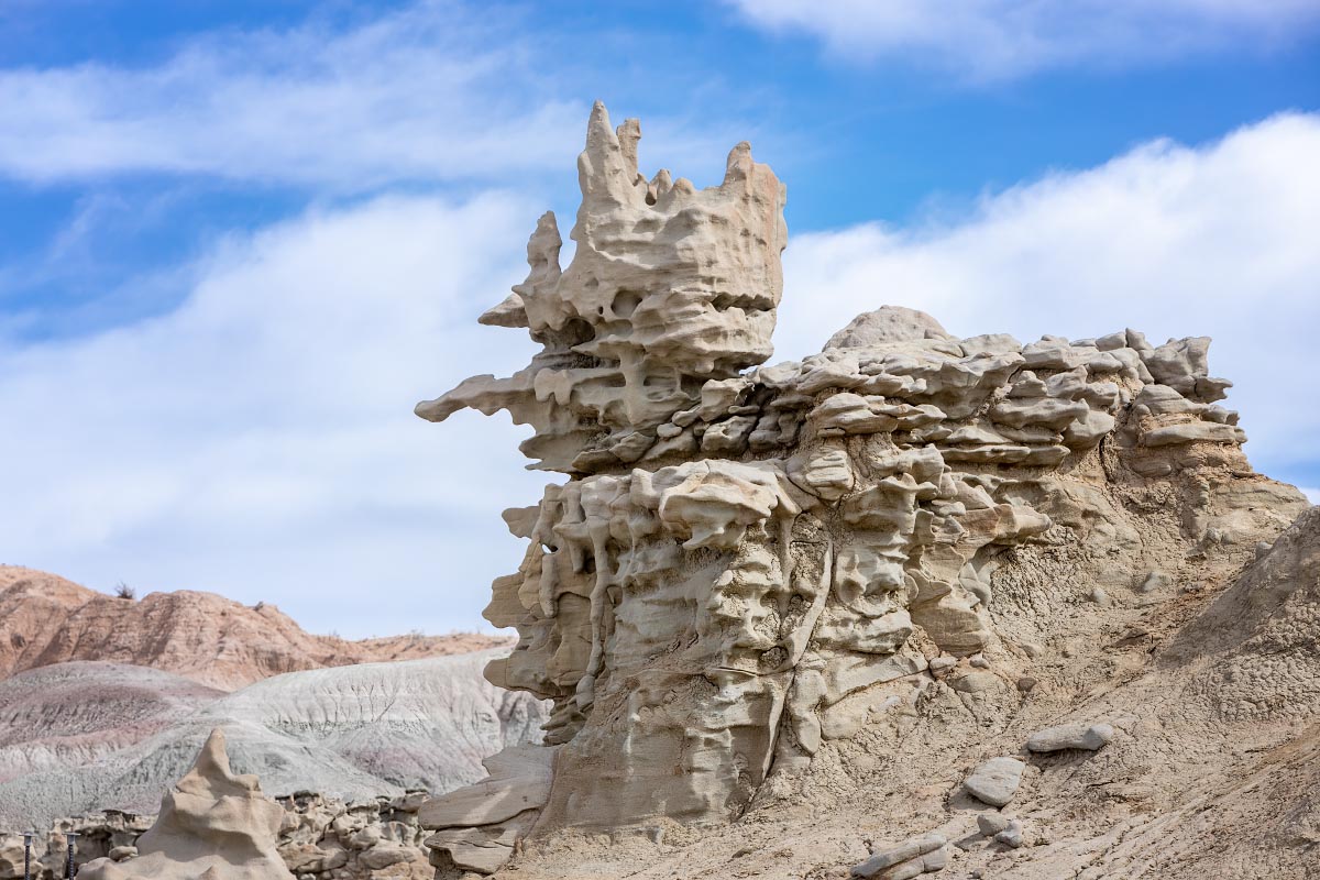
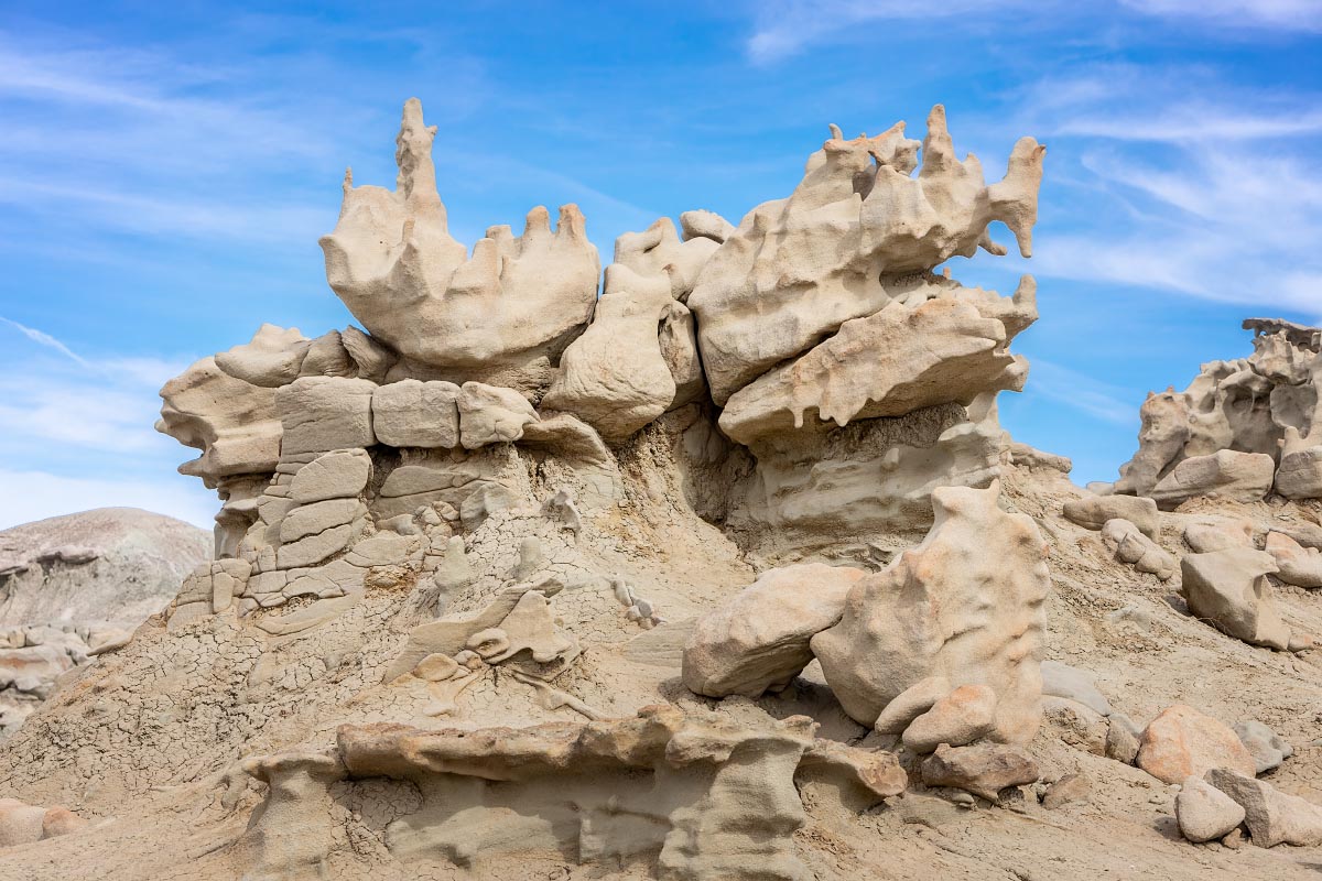
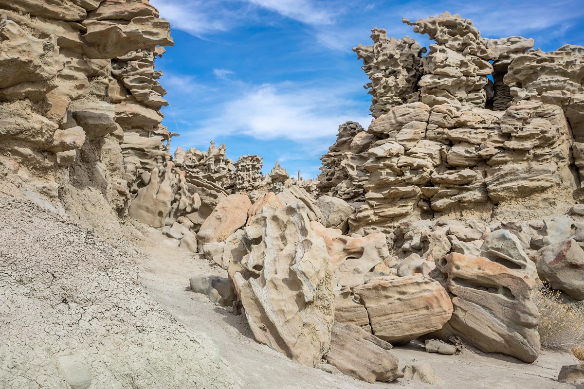
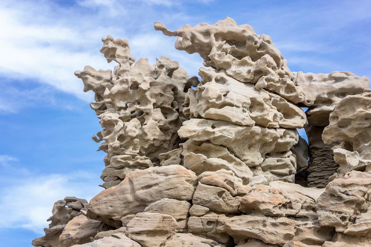
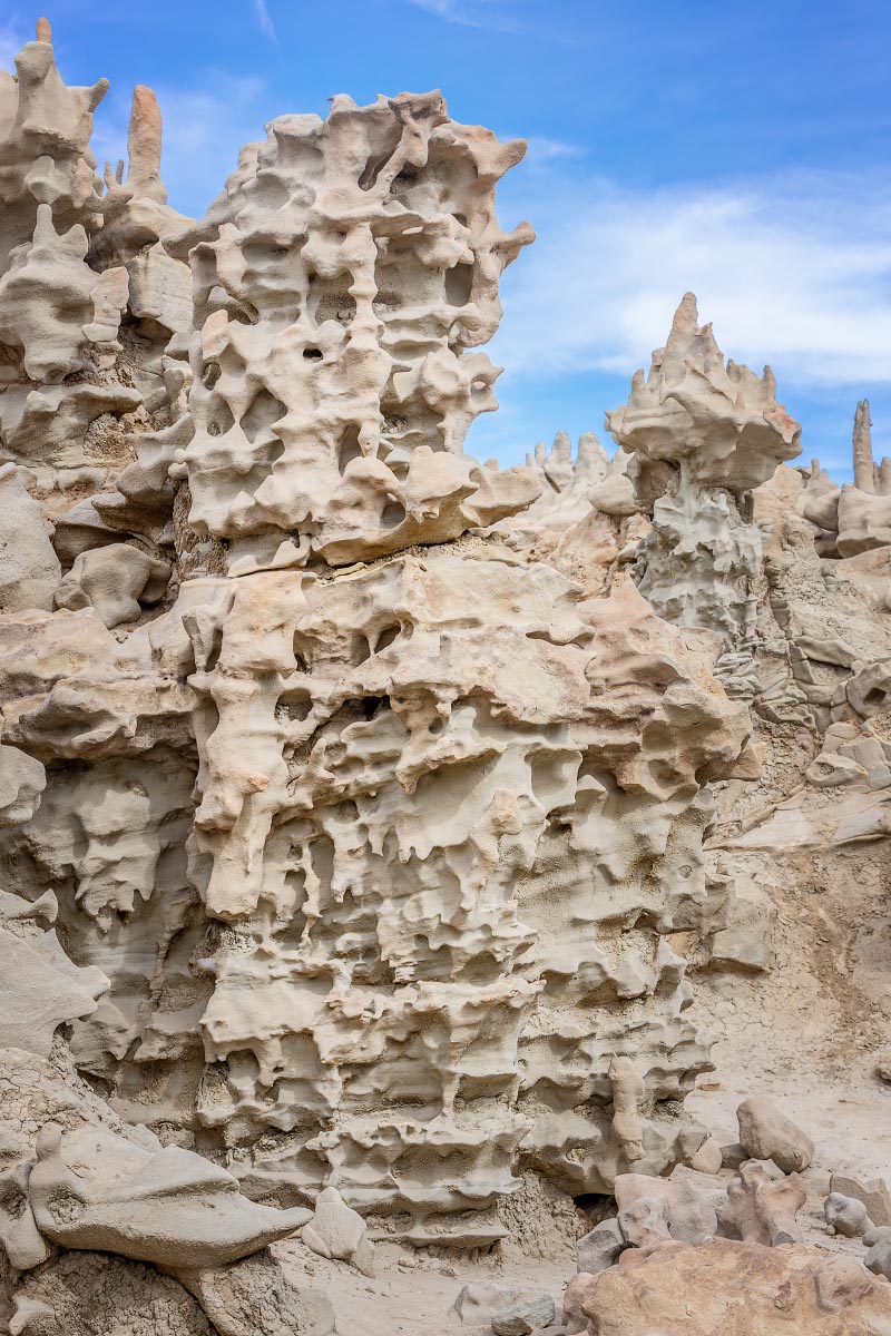
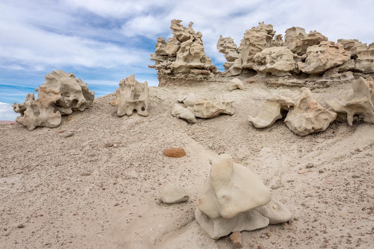
3/26/22: Vernal, UT was the halfway point heading back home and we decided to spend the night there. Previously we had visited Dinosaur National Monument which was fascinating. This time we decided to try to find something definitely far off the beaten path known as Fantasy Canyon. These are certainly the most bizarre rock formations we’ve ever seen.
I call this one Rumpelstiltskin.
Fantasy Canyon
Candy calls this one broken eggshells.
Fantasy Canyon
Fantasy Canyon
Fantasy Canyon
Fantasy Canyon
Fantasy Canyon
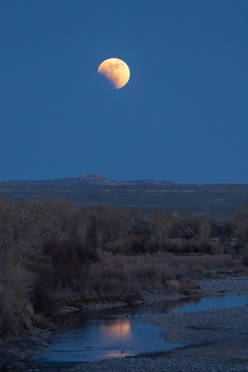
5/15/22: Good view from our back deck of the partial lunar eclipse over the very dry Wind River.
Lunar eclipse over the Wind River
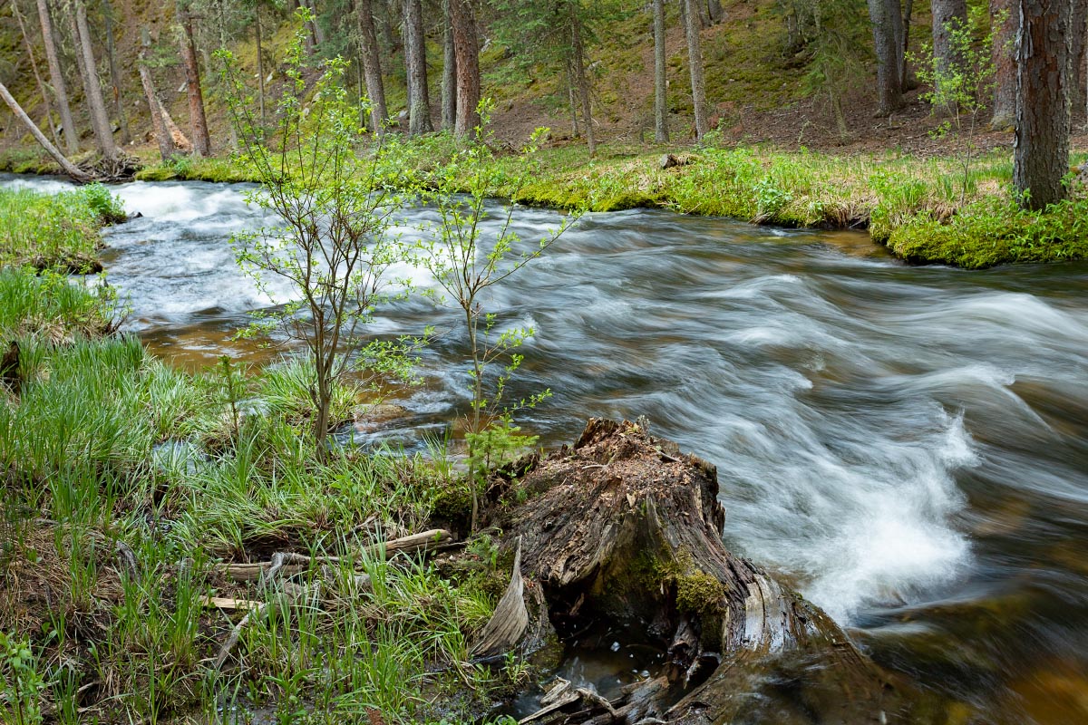
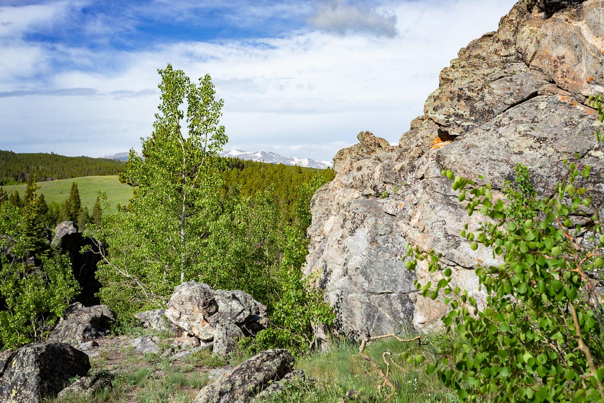
6/18/2022: Camped at Middle Fork Campground in the Big Horn Mountains this weekend. Middle Clear Creek ran just behind our campsite.
Middle Clear Creek
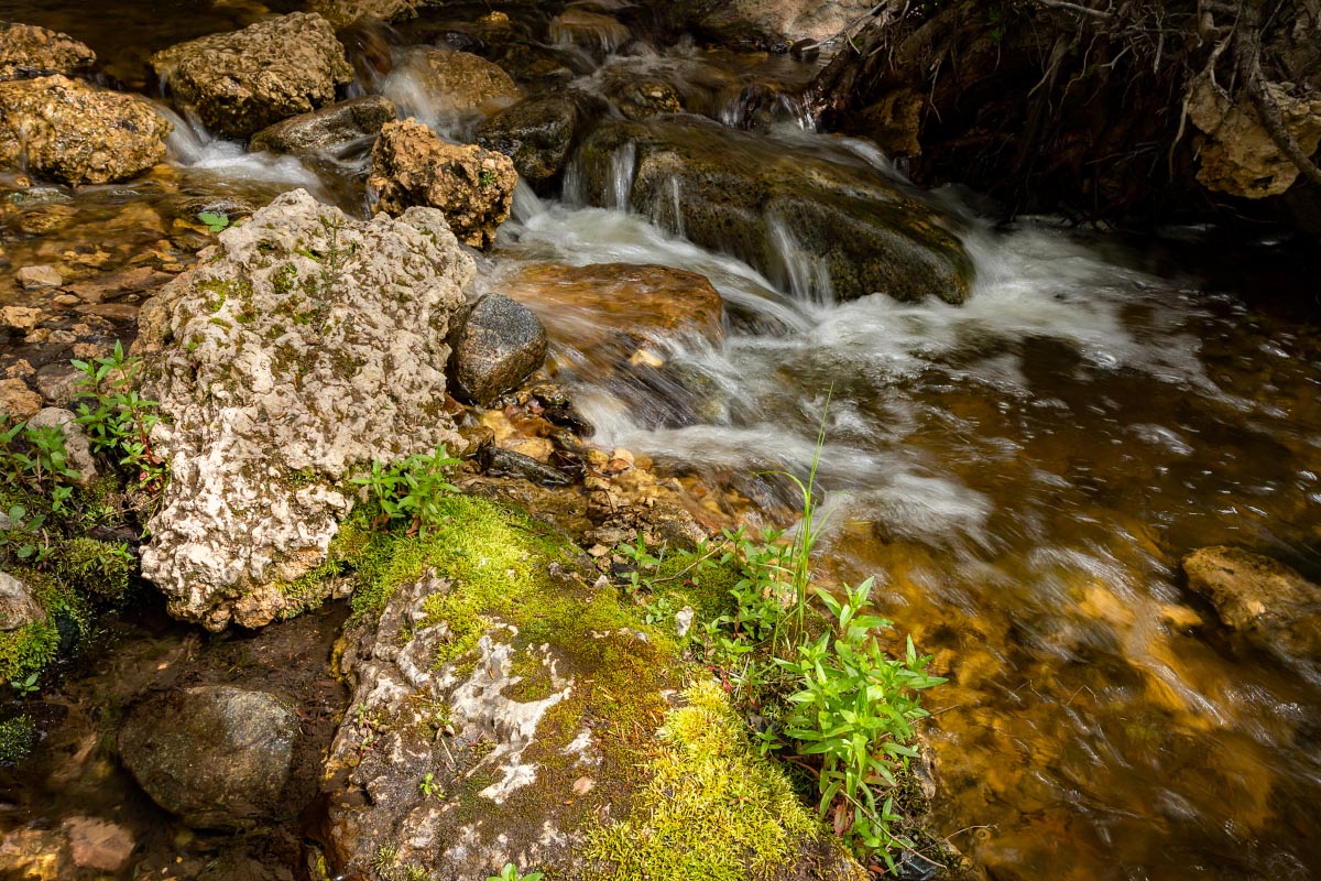
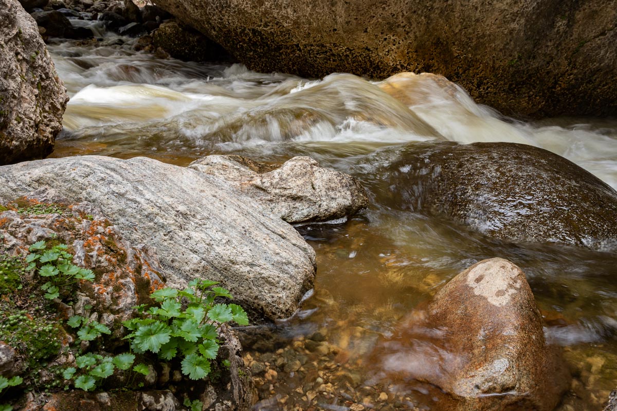
Had fun walking around Crazy Woman Canyon carved by, what else, Crazy Woman Creek.
Crazy Woman Creek
Crazy Woman Creek
Crazy Woman Creek
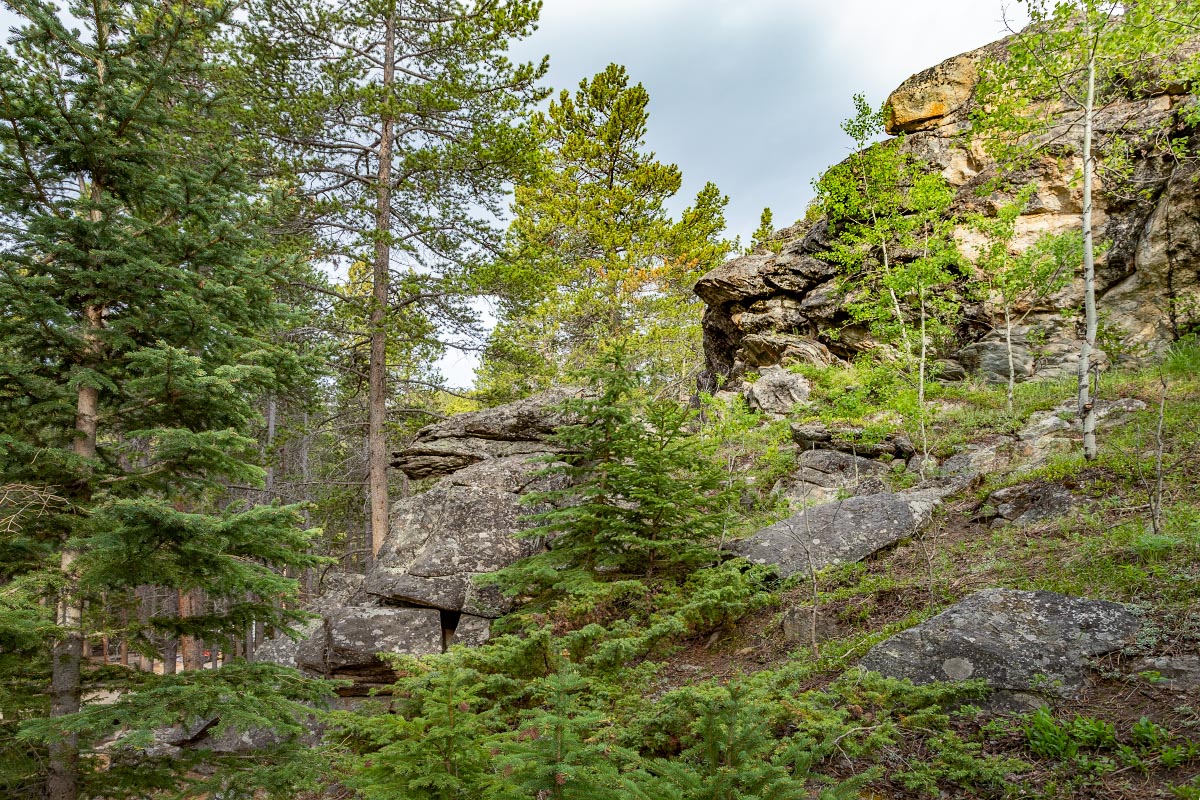
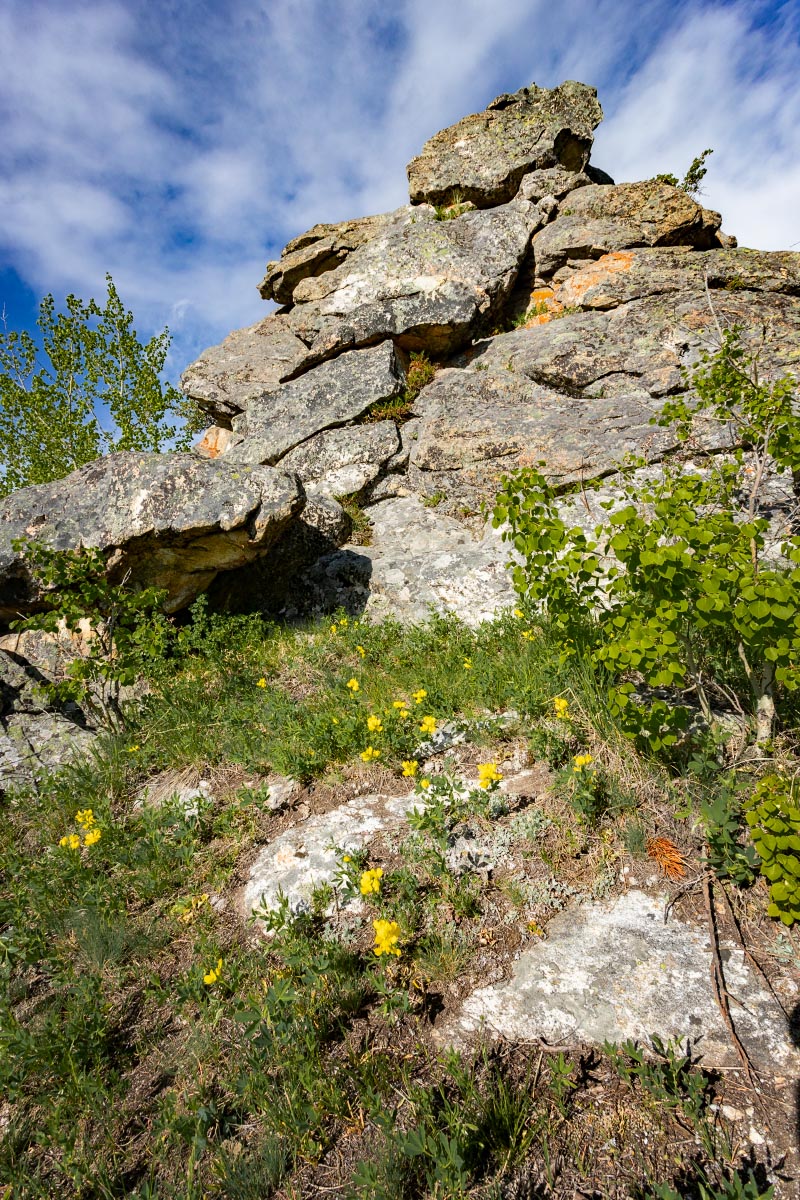
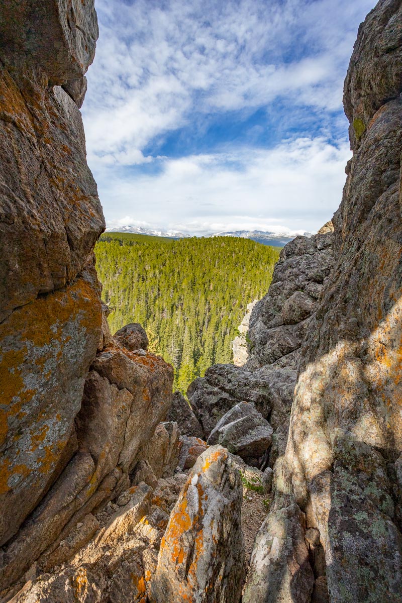
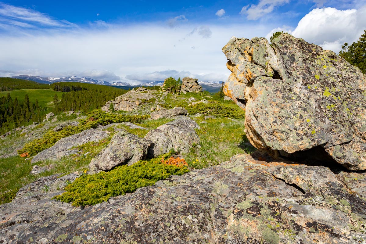
One of our favorite things about this campground is climbing the hill across from our campsite to a very private scenic plateau.
Middle Fork Campground
Middle Fork Campground
Middle Fork Campground
Jackson calls this “The Window”.
Middle Fork Campground
Middle Fork Campground
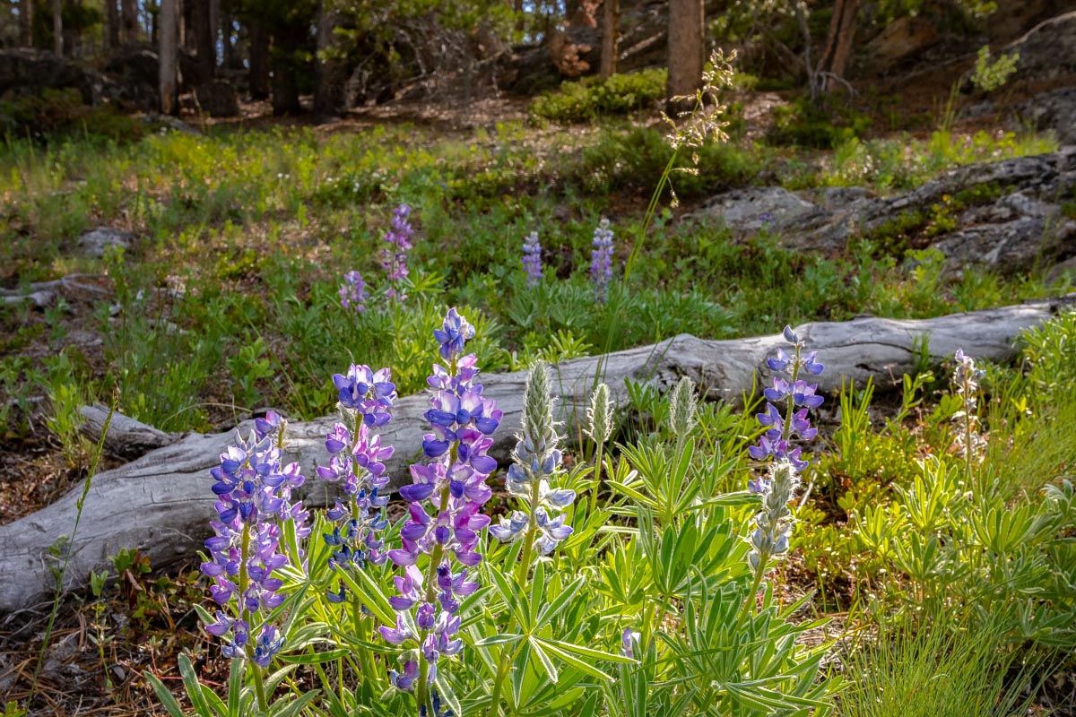
Lupine
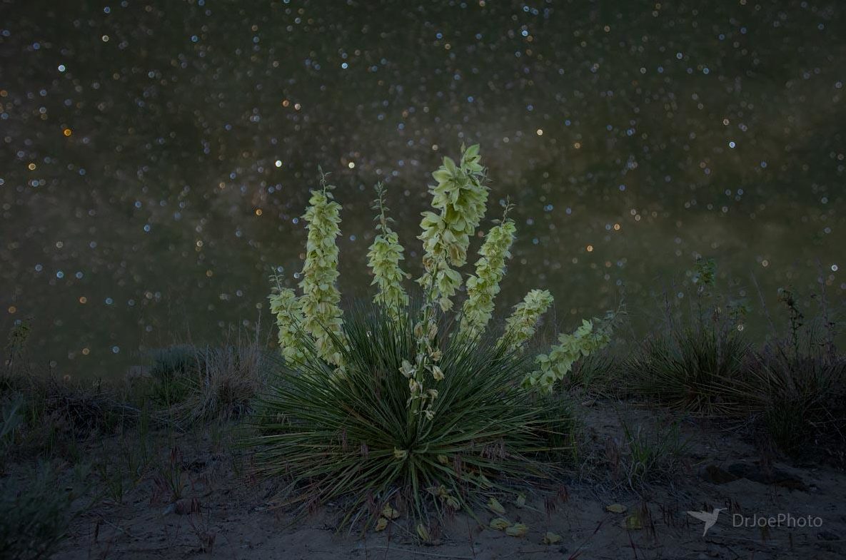
Often during our eight years in Wyoming, we’ve noticed yucca plants out in the sagebrush, but we had never seen them bloom. I later learned that they can go for a number of years without blooming. Coming home from our camping trip in the BigHorns, we noticed great expanses of profuse Yucca blooms. It was a beautiful sight to see, and I decided to go back a few days later for a nighttime photo. The yucca is the ultimate story of a symbiotic relationship. A particular species of yucca moth is the sole pollinator of the Soapweed Yucca, and this yucca is the only caterpillar host for that yucca moth.
Soapweed Yucca
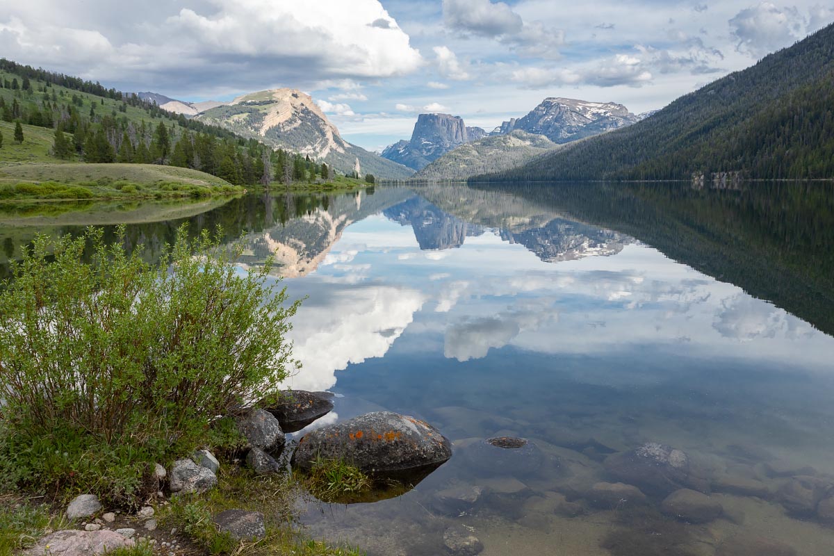
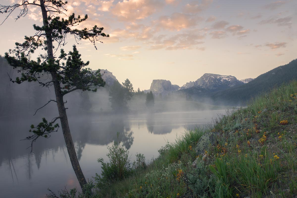
7/1/2022: We decided to tackle the very difficult journey to Green River Lakes. It’s been 3 years since we went to Green River Lakes. Towing a small camper trailer, the last 18 miles took 1 hour and 45 minutes to drive. Also for the second time, our camper suffered some damage, but it was worth it. Our first evening had calm water on Lower Green River Lake for this amazing reflection of Squaretop Mountain.
Green River Lake and Squaretop Mountain
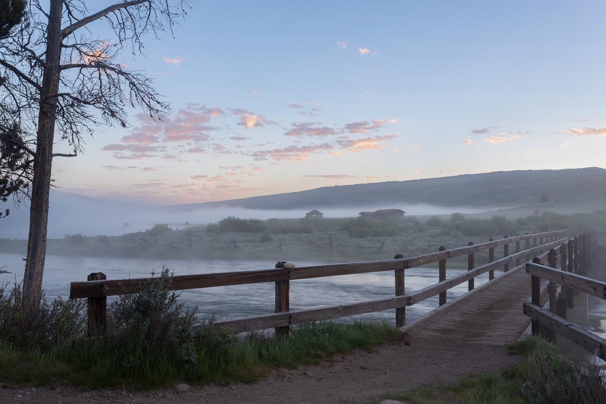
The following morning I went down to the lake for sunrise. At first I was disappointed because of the dense fog. I’m glad I stuck it out as a wonderful scene later unfolded. The first photo is looking across the Green River to the Osborn Cabins.
Green River sunrise
Without moving the tripod, I then swung the camera around to see this…
Squaretop Mountain sunrise
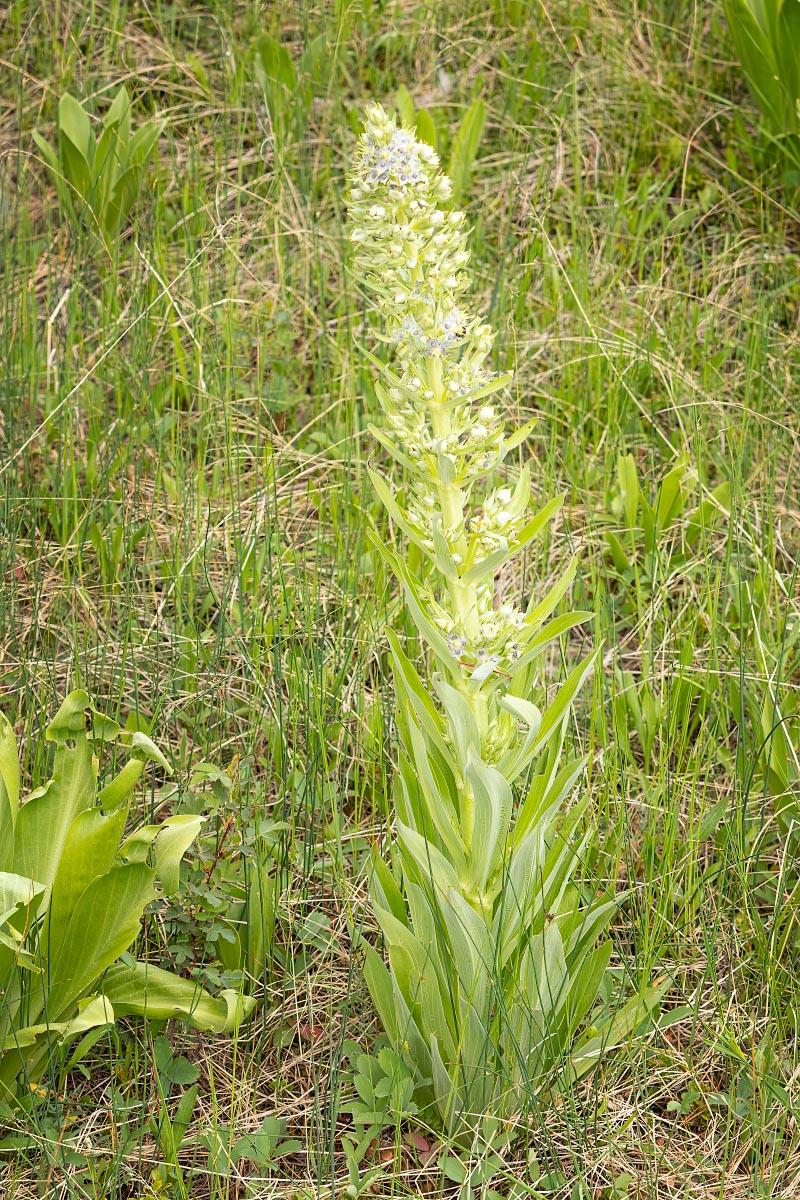
Along the lakeshore, Katherine spotted a new wildflower for us. This is called the Monument Plant. I can grow for as much as 20 years before blooming. Once it blooms, it dies.
Monument Plant
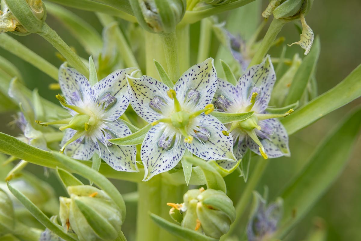
The flower stalk can grow as high as 4-6 feet tall. Each individual flower is amazingly intricate.
Monument Plant
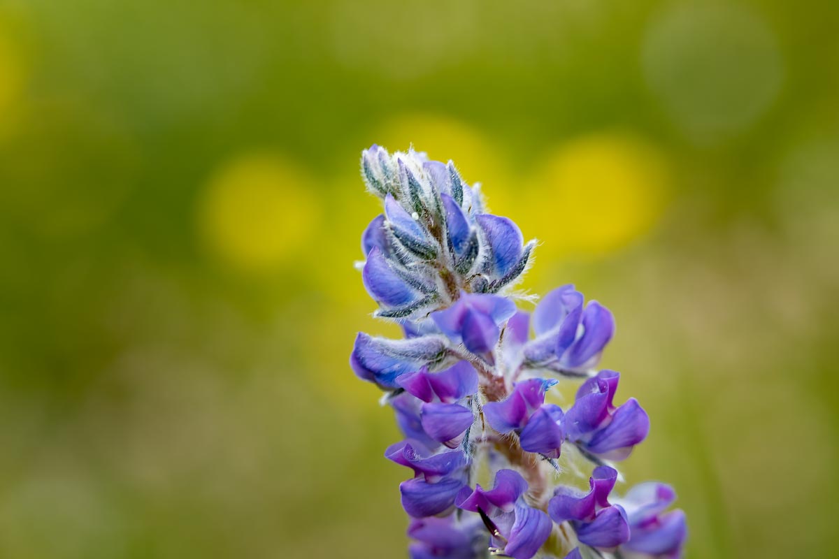
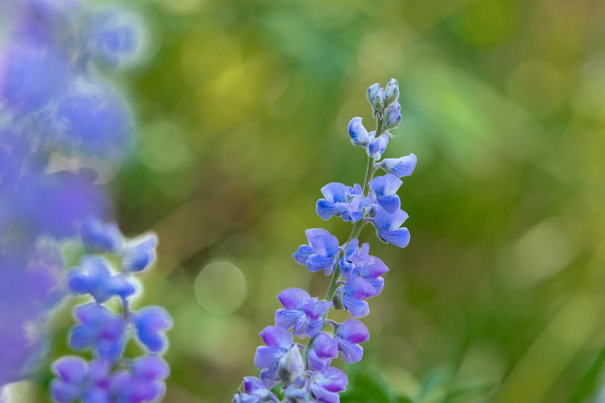
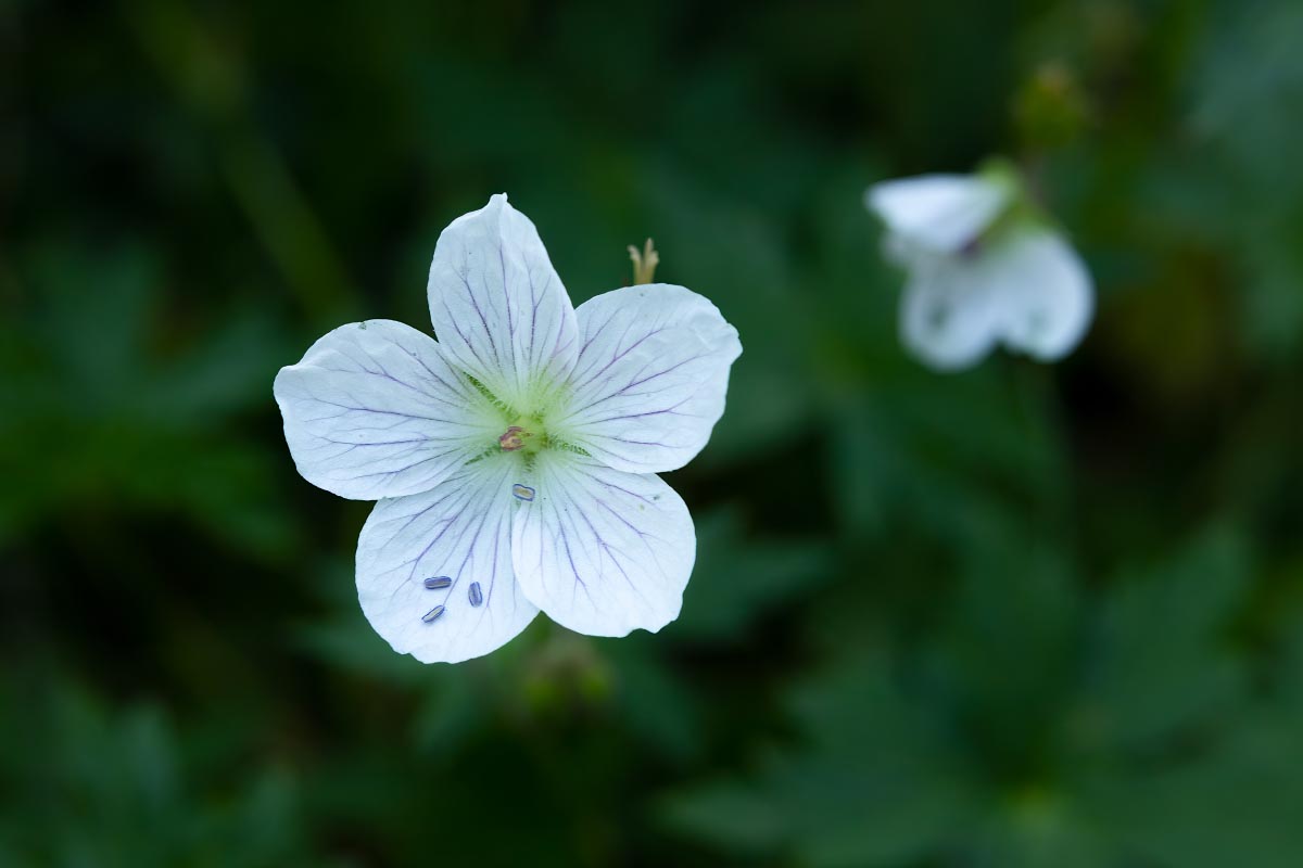
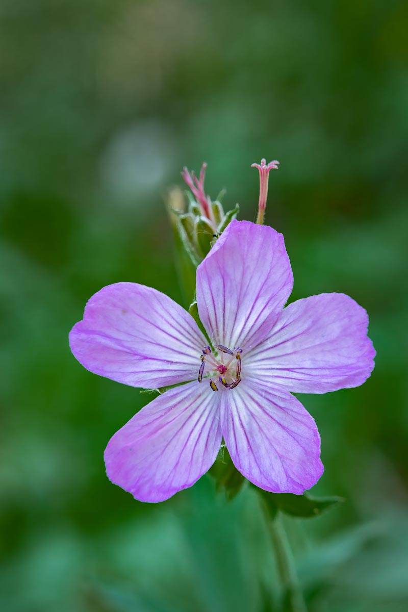
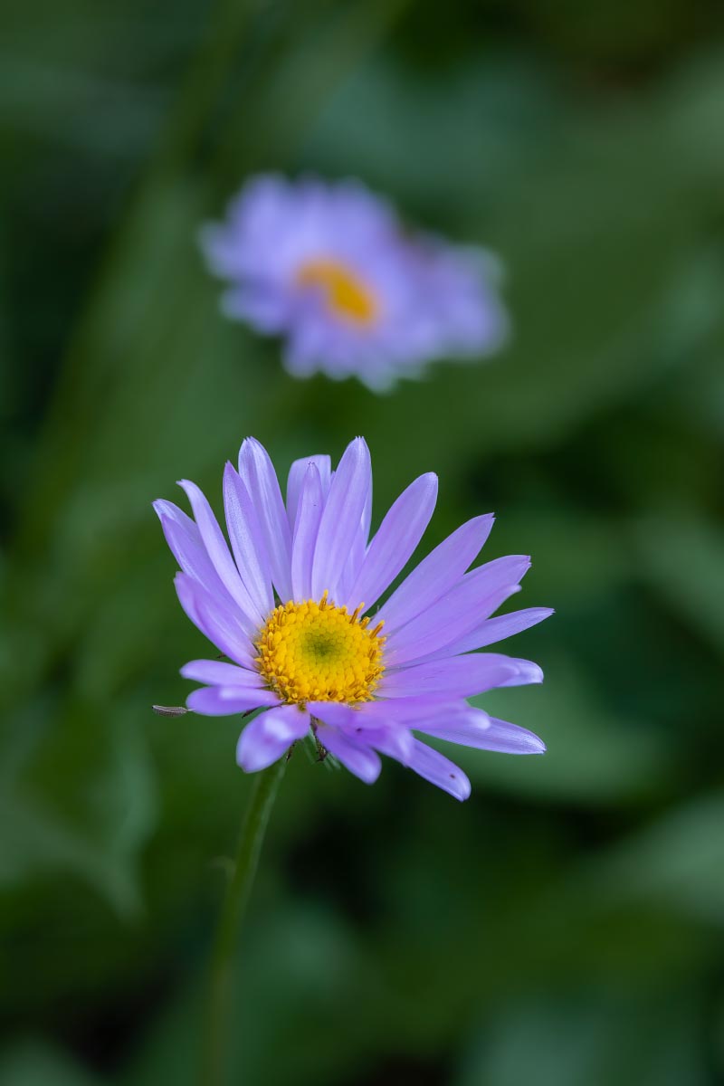
All of the following wildflowers were photographed at our campsite.
Lupine
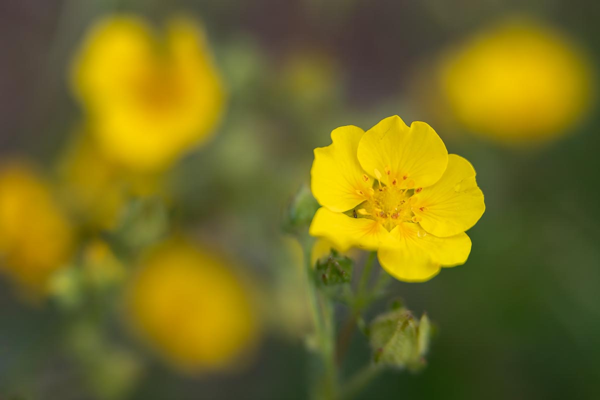
Cinquefoil
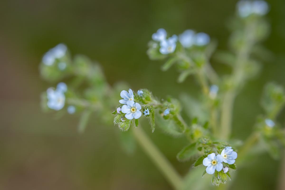
Flatspine Stickseed
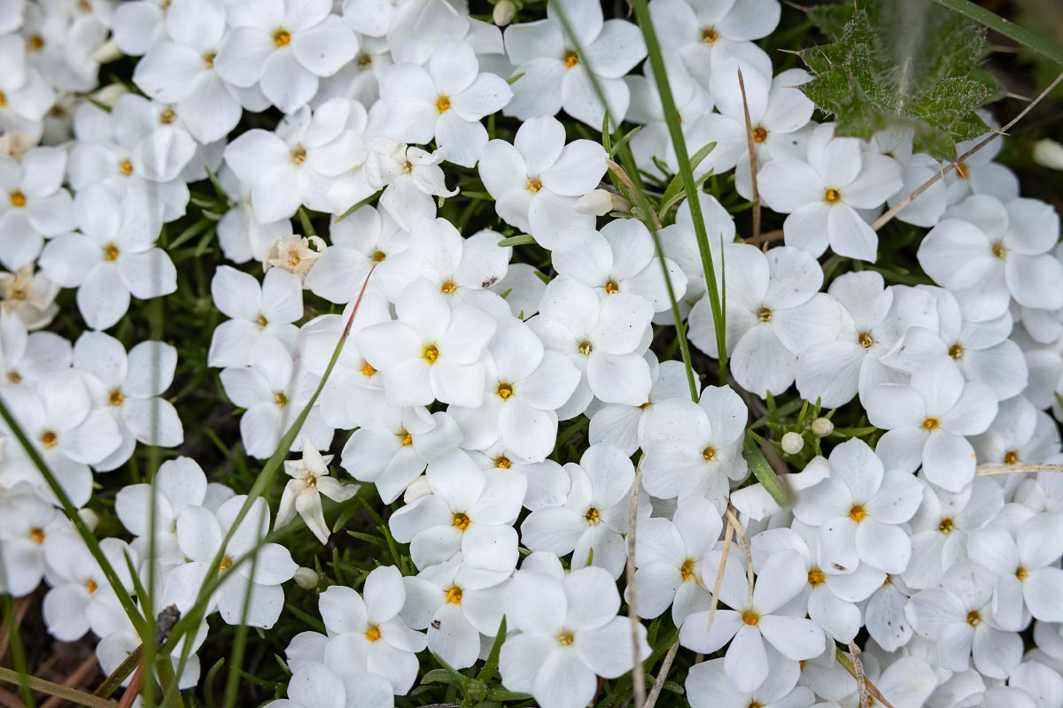
Rocky Mountain Phlox
Sunday we hiked around Lower Green River Lake. It’s about an 8 mile hike which is probably my limit, so I did not take any camera equipment with me, just my phone. See my blog post from 2019 for more photos, but I just had to take a short video when we spotted a moose feeding in a pond next to the lake.
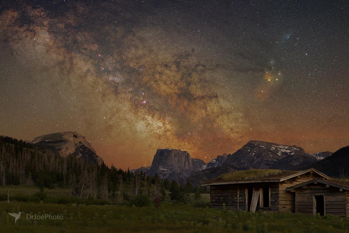
Rather than take the popular Milky Way shot by the lake, I decided to go back to the Osborn cabins for a new perspective. What do you think?
Squaretop Milky Way
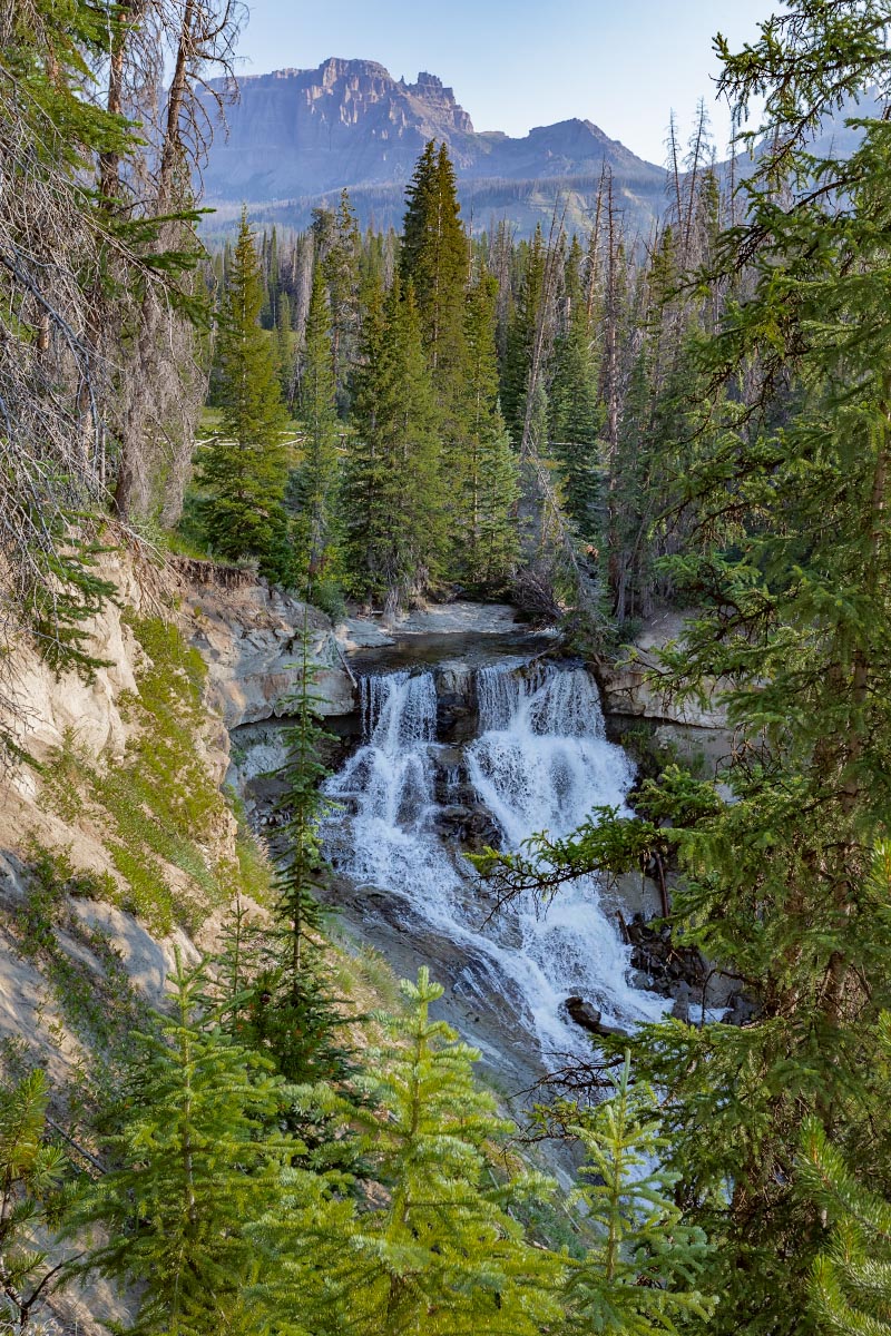
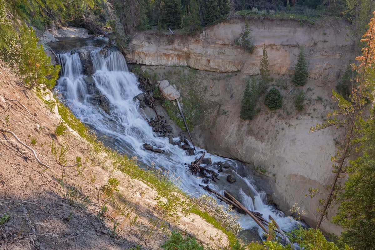
7/30/2022: At least once a year we go up to our favorite Falls Campground. Never get tried of taking the short walk to Brooks Creek Falls.
Brooks Creek Falls
Brooks Creek Falls
Brooks Creek Falls
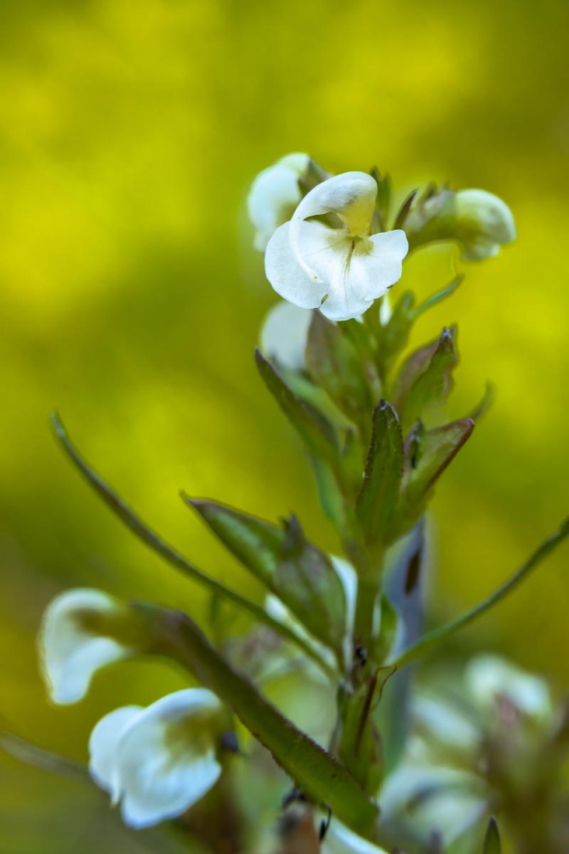
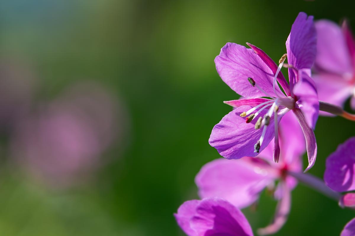
Yes. great place for wildflowers too.
I don’t know who came up with the second part of this wildflower’s name, but the first part is very descriptive.